Our top 10 best day hikes near Taipei (with GPX)
Taipei truly is a hiking paradise; it’s surrounded by an extensive network of trails, offering everything from scenic short hikes to full-day adventures. In just 30 minutes to an hour, you can journey from the city’s urban bustle to the heart of lush, green jungle. We’ve put together our top 10 favourite hikes around Taipei, all chosen for their easy access via public transport, so no need to worry about the logistics of getting to the trailhead and back. Each hike is just 1 to 2 hours away from the bustling metropolis, offering a diverse range of landscapes and experiences. These trails are very diverse and also offer a bit longer hikes that will keep you busy for a good daytrip outside of the city. For all hikes it is advisable to wear hiking or (trail)running shoes and bring plenty of water and snacks, as most routes describe some longer trails without any food or drink options along the trails. For trail-running enthusiasts: most of these trails are perfect for running too!
1- Sandiaoling waterfall trail
Length: ca. 9km, elevation gain: ca. 400m
This waterfall adventure starts at Sandiaoling train stations and finish in the charming Houtong Cat Village. As soon as you step off the train in Sandiaoling, head straight to the trailhead and follow the signs up the hills for the Sandiaoling Waterfall Hike. The trail leads you to a series of stunning waterfalls, each one more breathtaking than the last. The well-maintained path winds through an impressive jungle, crosses crystal-clear rivers, and keeps you busy while enjoying the changing scenery. After descending some steep stairs, you’ll find yourself back in civilization—only this time, it’s not just any village; it’s Houtong, the famous cat village! Here, you can relax in cozy cafés and restaurants, surrounded by an overload of adorable cats; a perfect way to unwind after your hike.
If hiking is a bit too slow for your taste, there’s a yearly trail race that takes you along the waterfalls. Organized every April by Venture Treks, a social running club based in Taipei, the Shifen Trail Race offers a thrilling way to experience the beauty of the trail while exploring your limits. Check out their website for more details or other exciting races: https://venturetreks.asia/
2 -Taoyuan Valley Trail + Caoling Historic Traill
Length: ca. 17km, elevation gain: ca. 1.000m
We keep coming back to this trail; it’s such a beautiful and diverse hike, offering stunning panoramas of Taiwan’s northwest coast. The trail winds along an old Japanese path, beautifully laid out and well-marked, with the occasional surprise encounter with grazing water buffalo. In the background you’ll glimpse views of the iconic, turtle-shaped island off the coast of Yilan. The trail ascend through a dense forest until you reach the green grasslands, which are especially vibrant when the silver grass blooms from late October to January. Our preferred route starts at Daxi train station, where you’ll first tackle a set of steep stairs leading up to the ridgeline. Trust us, it’s much better to go up these stairs in slippery weather than to end your hike here and risk sliding down! The hike then takes you across the grasslands, eventually leading you to Fulong train station, where you can also take a dip in the ocean at Fulong beach – a perfect way to end a rewarding day on the trail.
If you’re looking for a shorter hike, you can opt for the route between Dali and Fulong stations, which will take you up to the first viewpoint in the grasslands.
3) Wuliaojian hike
Length: ca. 5km, elevation gain: ca. 500m
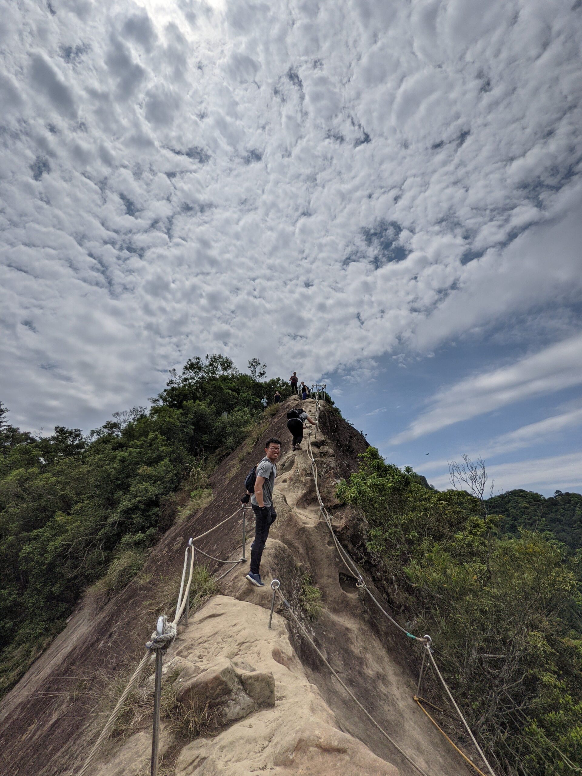
If you like ropes this hike is for you! Definitely don’t underestimate this hike, it is a short one, but will keep you busy. We really enjoy this one, even Erik who has a fear of heights… The trail starts with a steep climb over rocks and tree roots, using ropes at the steepest parts, until you reach the ridgeline. Just when you think the rope work is over, the real thrill begins! To continue the trail, you’ll need to lower yourself down a steep wall using ropes. It sounds more scary than it actually is, and the views are totally worth it. A tip: many hikers wear gloves to protect their hands from blisters on this trail.
To get to the trailhead you can take the metro to the last stop on the green line (Dingpu station), then grab a taxi or bus to the trailhead (map code: V9MG+JR). Keep in mind that the trail can get pretty crowded on weekends. After the hike, Sanxia Old Street is a great spot to refuel with some traditional Taiwanese dishes.
4 -Yangmingshan fumarole hike and grasslands
Length: ca. 8km, elevation gain: ca. 500m
This unique hike is located in the Yangmingshan National Park, just outside of Taipei. It’s famous for its volcanic activity, including active sulphur pits, fumaroles, and hot springs. The trail begins at the Xiaoyoukeng Visitor Center, where you’ll immediately notice the strong scent of sulphur and see steam rising from the ground around the crater; a clear sign of the volcanic activity beneath your feet. To get there, take bus 1717 from Jiantan metro station in Taipei, which conveniently drops you off right at the visitor center.
As you ascend to the summit of Taipei’s highest peak, Mt. Qixing, you’ll pass through areas with active fumaroles, where hot steam and gases escape from cracks in the earth’s surface. Upon reaching the peak, at 1,120 meters above sea level, you’ll be greeted with sweeping panoramic views of the surrounding mountains, Taipei City, and, on clear days, the distant coastline. From the summit, the trail continues to the Lengshuikeng Visitor Center, where you can pick up the forest trail leading to the Qingtiangang Grasslands. From Qingtiangang, you can catch a bus back to Taipei at the Qingtiangang Visitor Center (make sure not to arrive too late, as the last busses leave around 5pm).
Tip: Another excellent spot in Yangmingshan is the Bayan Hot Springs. It’s a fantastic place to relax on a chilly winter day. You can reach the hot springs by taking bus 1717. For more info see: https://www.tracetaiwan.com/traces/151
5- Battleship rock to Beitou
Length: ca. 5km, elevation gain: ca. 250m
With stunning views over Taipei, impressive rock outcrops and forest trails, this hike is perfect if you have just half a day and want to end at a café or hot spring in Beitou. From Qilian MRT Station on the red line, you’ll start with a steep ascent that offers increasingly better views of the city with each step. The highlight of the hike is Battleship Rock, named for its shape resembling the prow of a ship. From here, you’ll follow the ridge line, enjoying the natural sandy paths as you descend towards Xin Beitou. The trail leads you through picturesque landscapes directly to the public hot spring in Beitou. After your hike, you can relax your muscles in the public hot springs or enjoy a hot spring egg for a protein boost. On sunny days Kahu craft beer garden is also a good place to relax, with a beautiful garden, pizza and beers, what more do you need!
6 – Wulai Laka trail
Length: ca. 20km, elevation gain: ca. 1000m
This trail feels like stepping into a Jurassic Park movie. It’s a longer hike that takes you from Wulai Old Street to the Neidong Waterfalls, immersing you in stunning jungle scenery. The path transitions from wide gravel roads to wilder, more remote terrain, though it is well maintained throughout. The hike begins with a zigzag ascent up the mountain ridge via a series of steps. Once you’ve climbed the ridge, you’ll follow a narrow forest path along steep, tree-covered slopes. The trail then descends into the Xinxian Recreation Area, where you can admire the Neidong Waterfalls at the bottom of the valley.
To reach the trailhead, take bus 849 from Xindian Station to Wulai Old Street. To complete the loop, you’ll need to walk back from Neidong Waterfall to Wulai, passing the impressive Wulai Waterfall along the way until you return to the Old Street. In Wulai, you’ll find a variety of hot spring options, from natural springs in the river to private hot spring rooms that you can rent for one or two hours. The old street also offers a diverse range of indigenous cuisine, from boar sausages to bamboo rice.
Tip: for more amazing hikes around Wulai you can read our guide on 3 historic trails near Wulai: https://onsgo.org/the-wulai-historic-cross-trails-hidden-gems-south-of-taipei/
7 – Teapot mountain + Stegosaurus ridge
Length: ca. 6km, elevation gain: ca. 500m
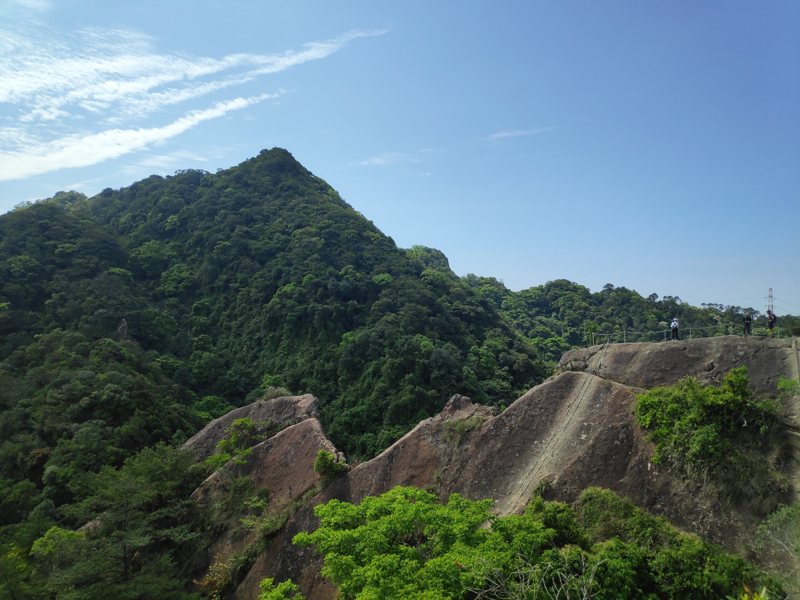
This hike takes you through rugged terrain and past the remnants of Taiwan’s gold mining history. The trail starts at the Gold Museum in Jinguashi with a series of stone steps that gradually ascend, offering glimpses of the coastline and the Pacific Ocean as you climb. One of the highlights of this hike is Teapot mountain, a large, teapot-shaped formation that gives the mountain its name. The rock’s distinctive shape provides a perfect photo opportunity, and you can climb through the “spout” of the teapot to the other side, adding a challenging element to the hike.
After passing through the teapot, the trail continues to the peak of Mount Banping, along the dramatic Stegosaurus Ridge. Here, you’re rewarded with sweeping views of the northeastern coastline and the surrounding grassy mountains on a clear day. Navigating this section of the trail involves tackling some steep slopes and using ropes for support, making it even more challenging. After traversing the ridge you’ll descent via a set of stairs back to the starting point of the hike.
This loop begins and ends at the Jiufen Gold Museum, which you can easily reach by bus 1062 from Taipei Zhongxiao Fuxing station or Taipei Main station. Nearby, Jiufen is a charming old village worth exploring, renowned for its traditional tea houses and bustling food street. However, be aware that it can get quite crowded in the evenings and on weekends.
8 – Maokong Yinhe cave waterfall trail
Length: ca. 11km, elevation gain: ca. 800m
Maokong is a scenic hill in Taipei that offers plenty of hiking opportunities and can even be reached by cable car. However, to get the most of it, this route takes you on a full ascent up Maokong, via temples, waterfalls, teahouses and through unspoiled sections of jungle.
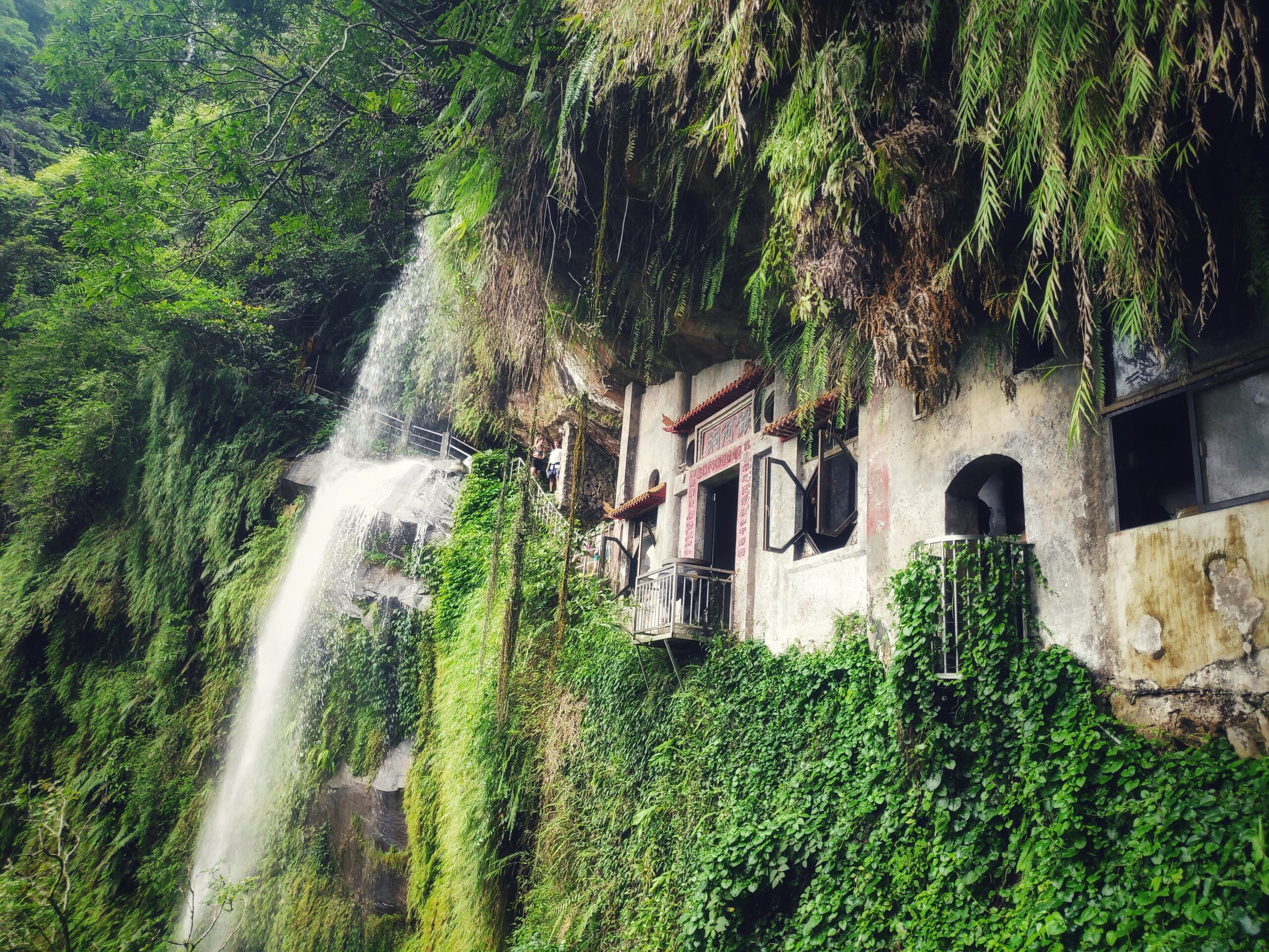
Starting from Taipei Zoo metro station, the route navigates through the city to a hidden set of stairs that take you up the beautiful Zhinan Temple. The first part of the trail is adorned with Japanese stone lanterns, giving a very serene vibe. After taking in the views from the temple, the trails takes you down the stairs via a dirt road through the jungle until you reach a small waterfall where you will hike further uphill. Along the way, you can stop for a refreshing tea break at one of the charming teahouses, such as the Yao Yue Teahouse. When you reach the Maokong gondola station, the trail descends toward Yinhe Cave Waterfall, a stunning temple set into the rockface with a waterfall cascading in front.
From here, you have a few options: you can hike back up to the Maokong gondola station and enjoy a scenic ride down, or continue your descent toward Xindian to reach the bus stop for the GR12, which departs about every hour and returns to Xindian MRT station. This GPX loops back to the Gondola station.
Tip: If you’d like to skip the first ascent, take the gondola up to either Zhinan Temple or Maokong station.
9 – Pinglin 1000 islands lake
Length: ca. 7km, elevation gain: ca. 500m
Just southeast of Taipei lies the Pinglin tea district. On the way, you’ll pass the scenic Taipei Reservoir, where rolling tea fields blend with dense forests, occasionally opening up to viewpoints over the reservoir’s waters. A great hike begins at the top of a nearby hill, accessible by bus GR12 that leaves Xindian MRT station at the end of the green line, take the bus to Xiaogetou (小格頭).
Starting here, the trail leads you down the road through the jungle until you’ll reach a stunning viewpoint with magical blue water below; if you look closely, you might even spot the “crocodile” shape formed by the reservoir’s islands. From the viewpoint you can return along the same trail if you only have half a day, or explore further zigzagging through fruit and tea fields before ascending back to the road. The route leads you past tea fields where you can pause to sample tea at one of the local farms, for example at 葉文鵬製茶廠. This GPX route ends at Helen’s Café, a popular spot for bikers and cyclists, where you can catch the GR12 bus back to Xindian at the Fenglouzui stop.
10 – Guanyingshan
Length: ca.8km, elevation gain: ca. 600m
This old volcano northwest of Taipei is located in the Bali District (not to be confused with Bali, Indonesia;) and offers numerous hiking opportunities with beautifull views over the ocean or Taipei city. In spring, the air is filled with the sweet fragrance of pomelo blossoms from the fruit trees scattered across the hills.
To start this hike, take bus 20 from Luzhou MRT station, the last stop on the orange line, to Guanyinshan bus stop. The trail can be a bit challenging, with some steep ascents, but the rewarding views make it well worth the effort. Looking for an extra challenge (or just a great way to turn a tropical getaway into a sweaty adventure)? Check out the Venture Treks website for their annual Bali Trail Race in this area!
The hike concludes at Bali Old Street, where you can catch a ferry to Tamsui on the other side of the river. Here you can have some snacks at Tamsui Old Street or enjoy the sunset and then take the metro back to Taipei from Tamsui station on the red line.
Extra Tips: For those looking for a multi-day adventure, there are beautiful and rewarding long-distance hikes around Taipei:
1) Consider tackling all or part of the 92 km Taipei Grand Trail for an immersive experience of the area’s landscapes and viewpoints. The trail is well marked and divided in 7 sections, which are described on this website: https://taipeigrandtrailen.gov.taipei/
2) Another excellent option is the Taipei Skyline Trail, which is almost 200km, offering breathtaking panoramas of the city and surrounding mountains, for more info check out this website: https://taiwantrailsandtales.com/taipei-skyline-trail/
Have fun out there!


