


The Wulai Historic Cross Trails: Hidden Gems south of Taipei
Three scienic historical trails can be found within an hour of Taipei, but unfortunately, it can be challenging to find comprehensive information about these trails online; translations from the websites made by the Taiwan government can be messy and often lack detailed information, making it harder for international visitors to get up to date information. This blog will provide you with some updates and practical information you need to plan for a successful hike.
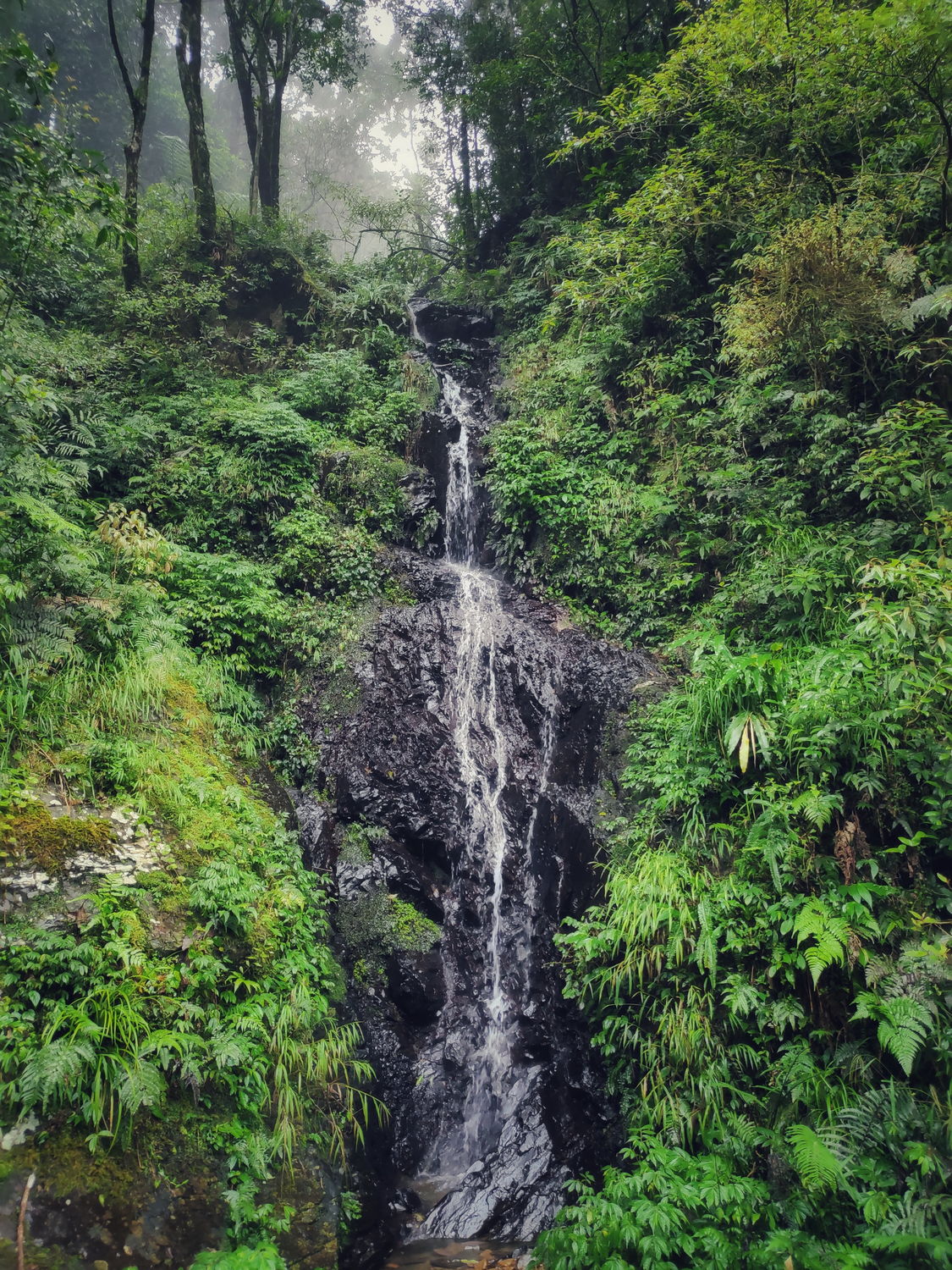
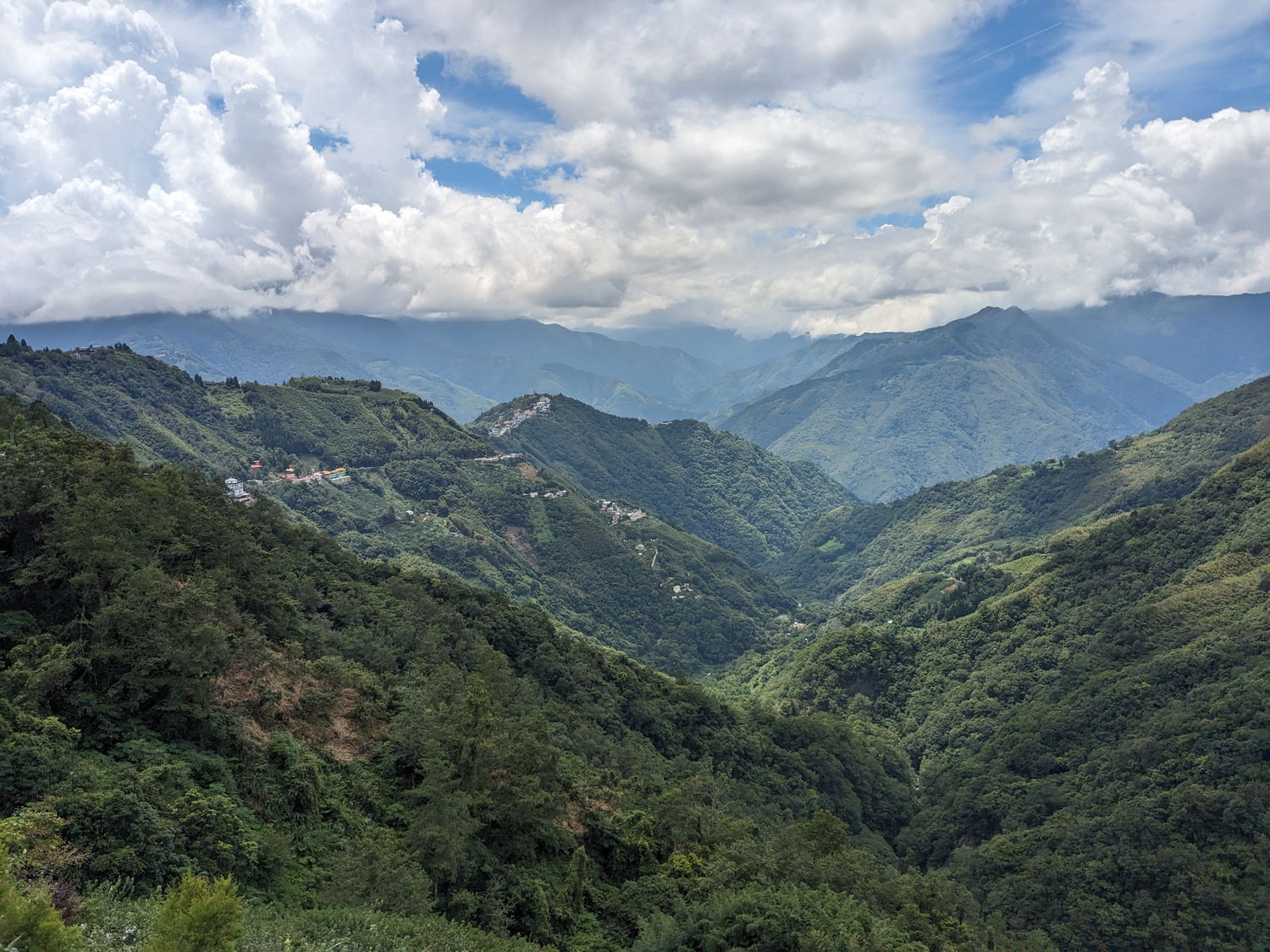
Wulai village is located about 1 hour south of Taipei by public transportation. It is known for its scenic beauty, indigenous culture, and natural hot springs. The village is surrounded by lush mountains, cascading waterfalls, and crystal-clear rivers. The hot springs are a popular destination for locals and tourists alike, and they are a nice treat during the colder winter months. Wulai is also home to the Atayal indigenous people, one of Taiwan’s 16 officially recognised tribes. The Atayal have a rich cultural heritage that dates back thousands of years. In Wulai, you can learn about their traditional way of life, art, and customs. And, of course, you can also sample the indigenous cuisine, which features ingredients such as bamboo shoots, local mushrooms, and wild boar.
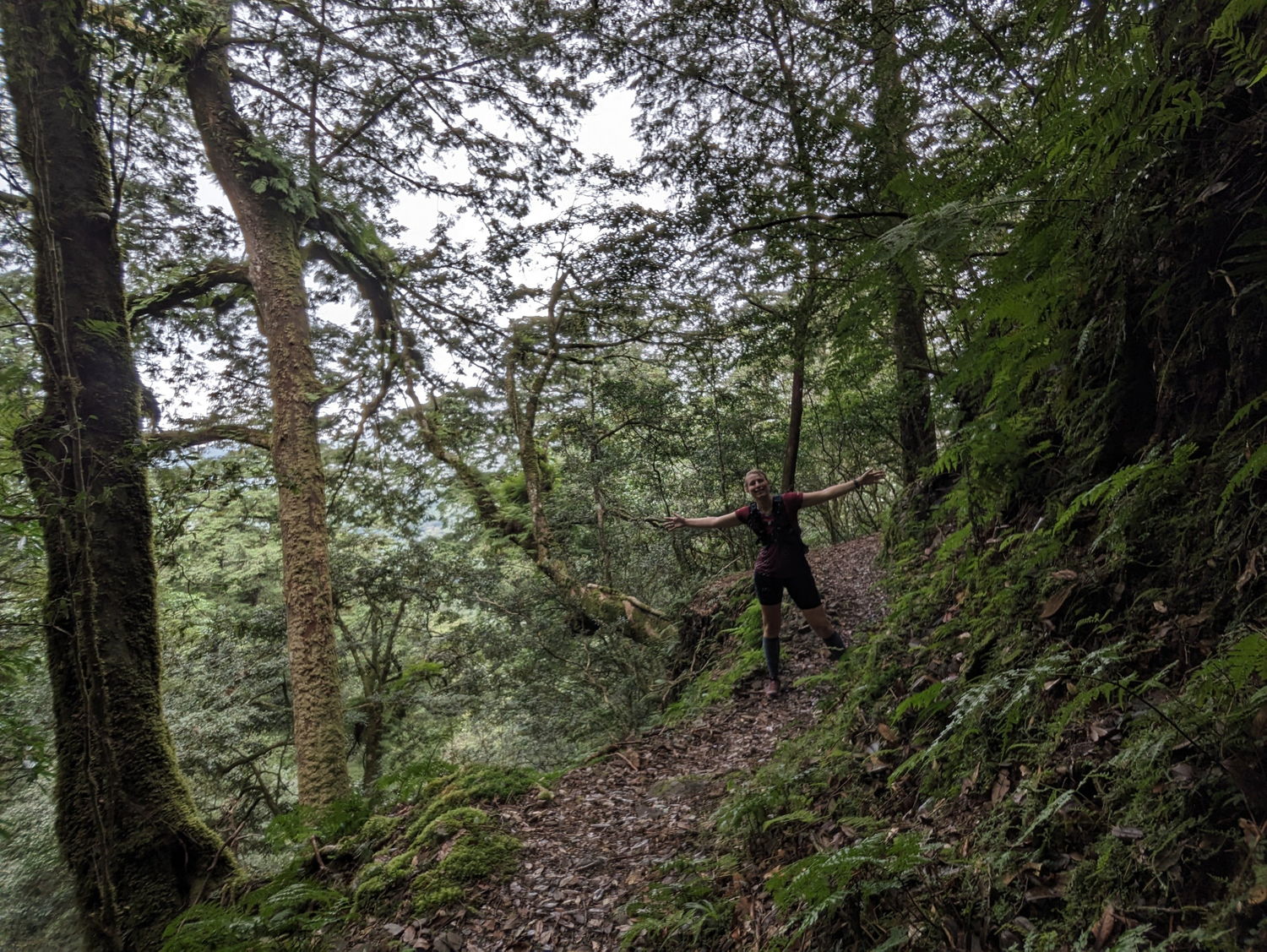
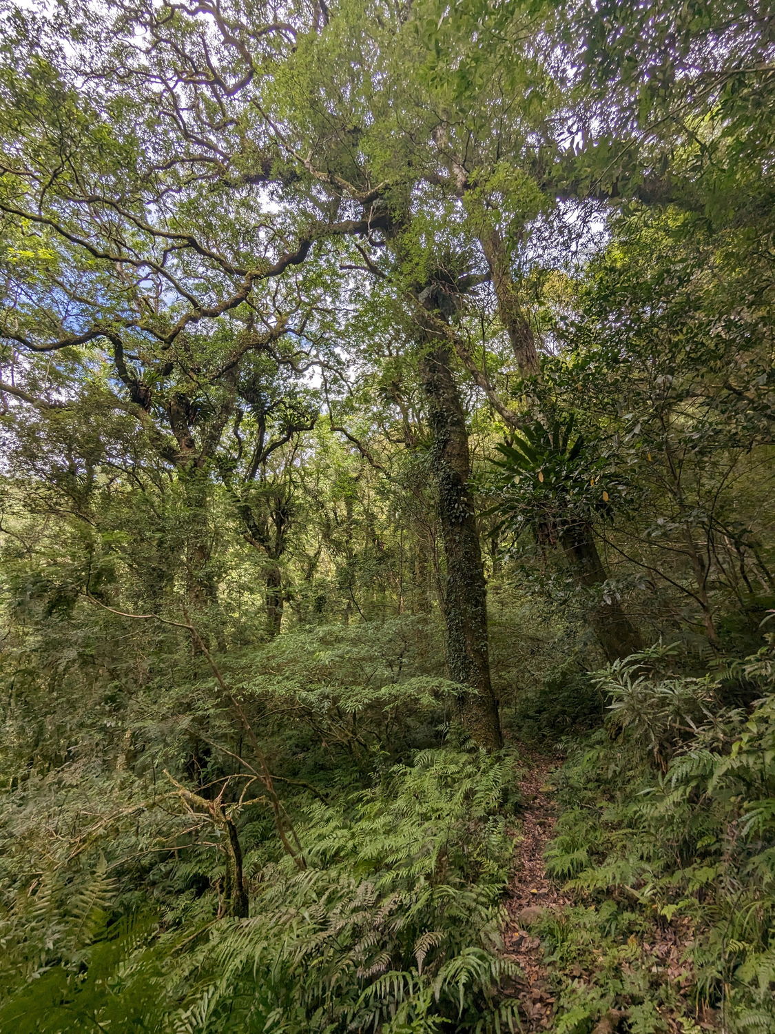
In addition to its natural beauty and indigenous culture, Wulai is also an excellent place for hiking. Many jungle trails start in the vicinity of Wulai and run through the surrounding mountains and forests. These trails cater to different levels of fitness and expertise, but there are a few in particular that are worth mentioning. We explored the three famous historic cross trails that connect Wulai district to other villages across the mountain ranges. These are longer trails and make up for adventurous day hikes: the Hapen Historic Trail, Fuba Cross Ridge Trail, and Tonghou Traversing Trail. They are all old tribal trails that were used for hunting and commuting, as they connect different indigenous mountain villages, and they are truly hidden gems!
- Tonghou traversing trail – 20 – 40 km (connects Wulai – Jiaoxi)
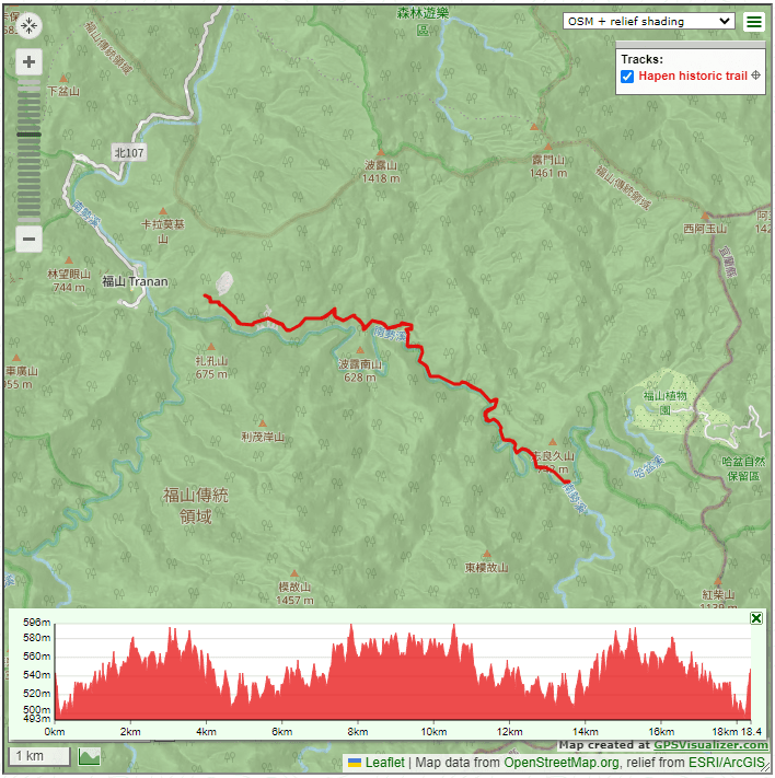
- Hapen historic trail – 20 km (connects Fushan – Yilan)
- Fuba Cross Ridge trail – 20 km (connects Fushan – Lalashan)
Unfortunately, the trailheads for all three trails are a bit difficult to reach, as there is no public transportation. But it is possible to reach all trailheads by taxi from Wulai village, or you can rent a car or scooter in Taipei if you plan to do an out-and-back hike. The trails are closed occasionally due to landslides after earthquakes and typhoons, so be sure to check trail conditions beforehand (we provide the relevant websites in this blog). Despite the challenges, these trails are definitely worth exploring, and at the time of writing (August 2023), they are all open and accessible.
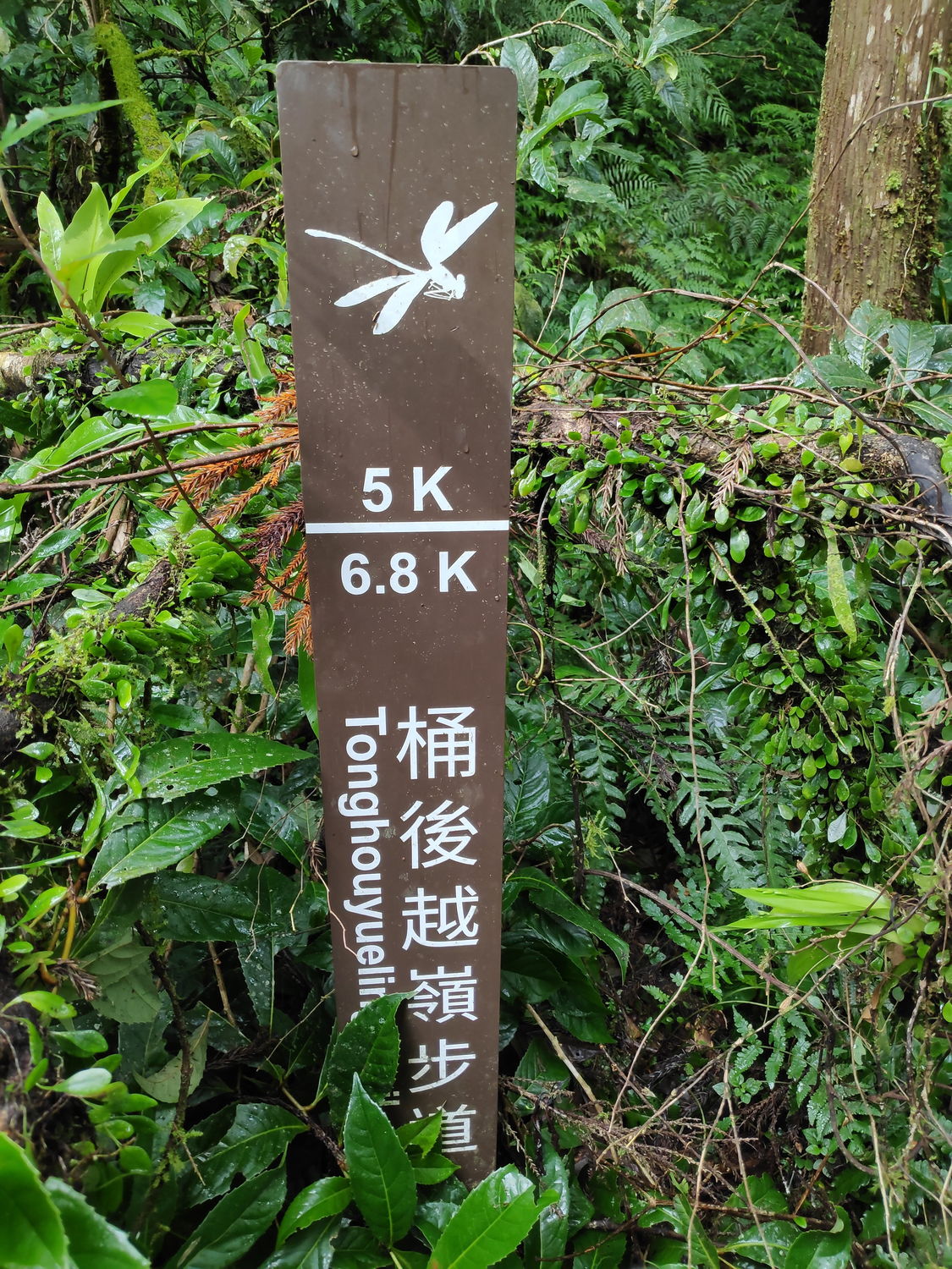
1 – Tonghou Traversing Trail
(桶后越嶺古道)
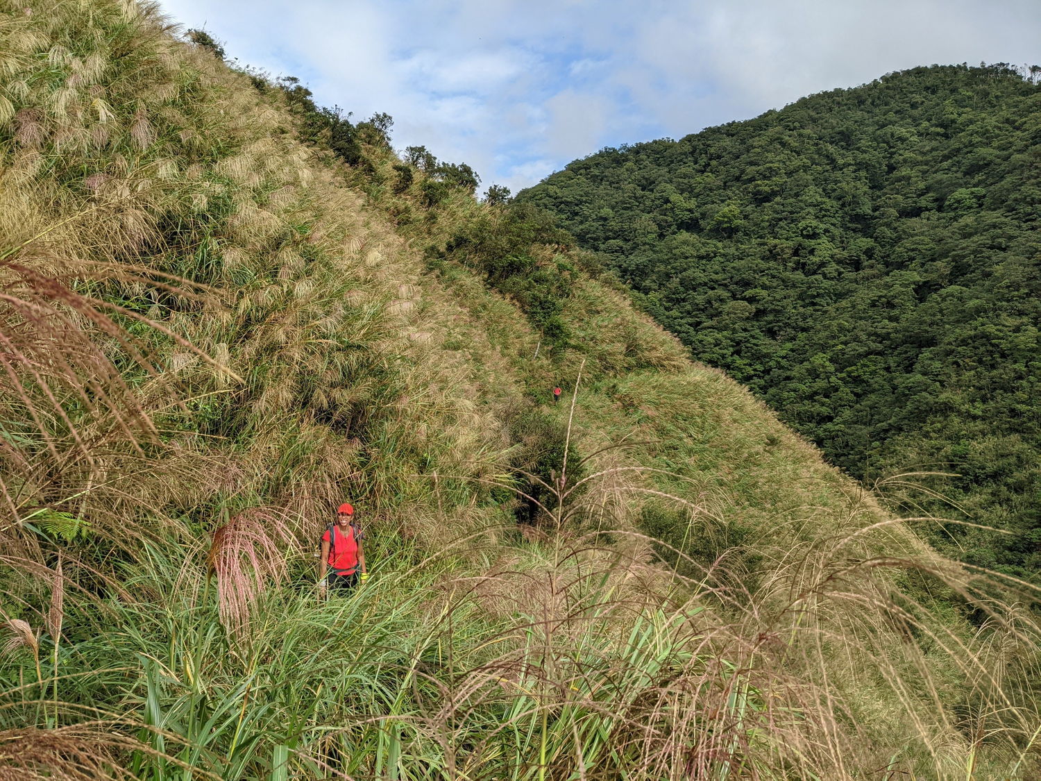
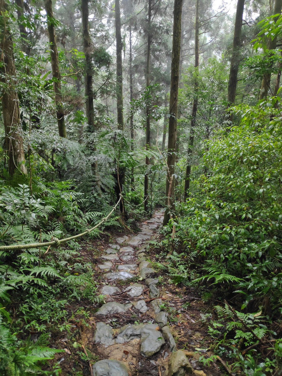
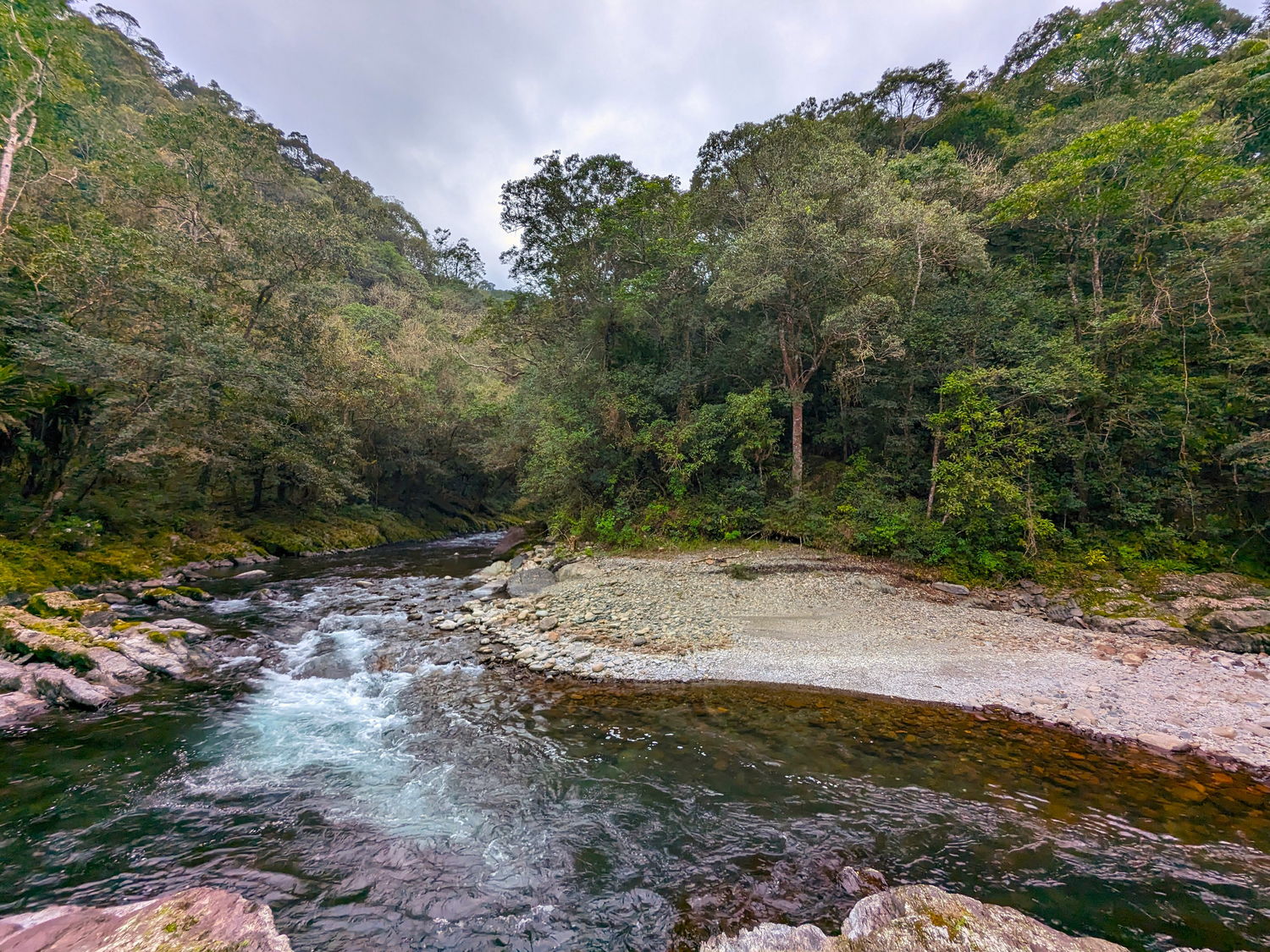
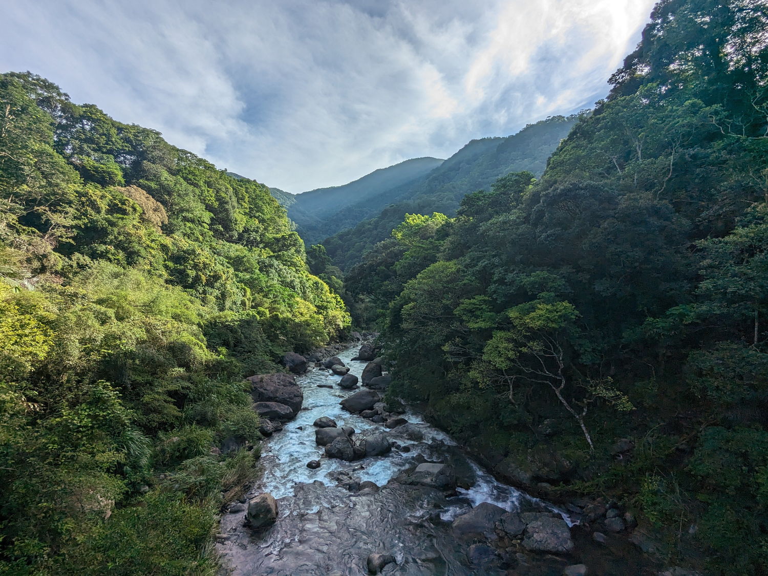
Wild rivers, lush forests and abundant silver grass are three things that define the beauty of this trail. In the early days, it was the mountain path the Atayal people would take to go hunting. During the Japanese occupation, the Japanese government rebuilt this trail for the purpose of transporting logs. Later, the Tonghou Traversing Trail was closed for a long time due to damages from a Typhoon in 2015. Now, the trail is reconstructed again and as a bonus, clearly marked.
If you come by your own transportation or are dropped off, turn left just before Wulai Old Street and follow the winding Xiaoyi Industry road (nr. 9) up to the Xiaoyi Police Station (no need to apply for permits). You can go a little further down the valley until a barrier checkpoint where you can park (see map). Sometimes taxis from Wulai drive all the way to the actual trailhead past the checkpoint, but we heard prices are very steep.
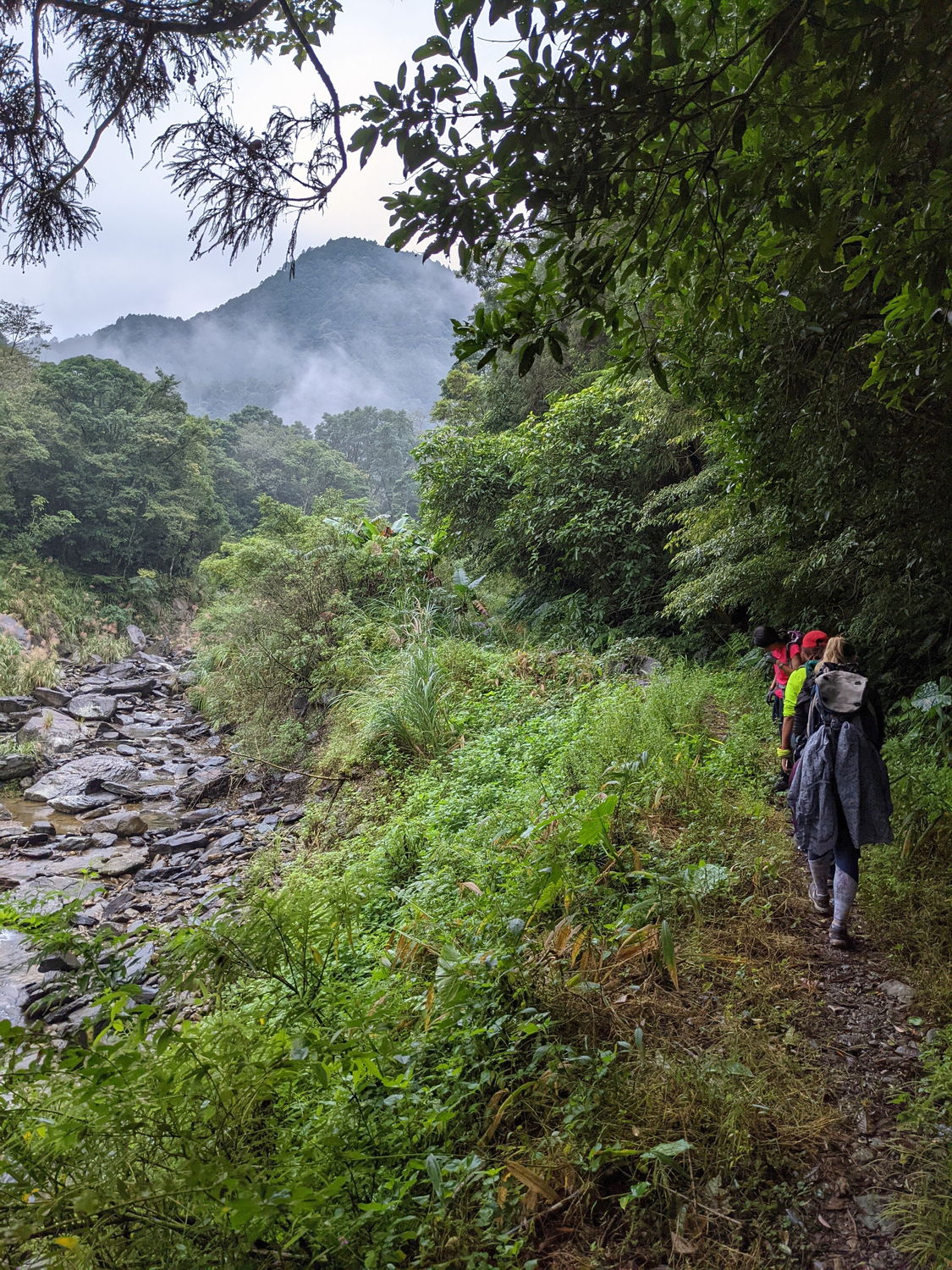
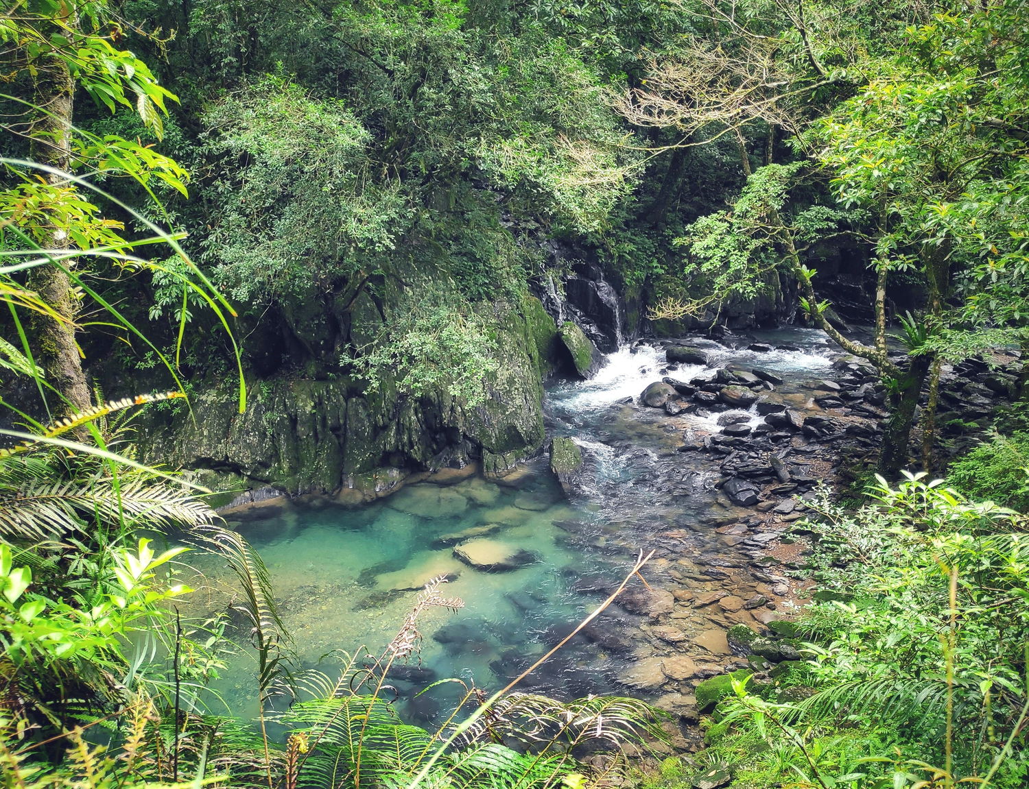
Starting from the checkpoint, you’ll be following the 13 km-long paved road to the actual trailhead. This section offers beautiful views of the surrounding mountains and you can keep an eye on the Tonghuo River down below in the valley. You’ll get closer to the river as you near the trailhead, on warm day there are some great spots along the trail to take a dip in the clear blue waters. The official traversing trail is only 7 km and follows the Tonghou River further upstream through dense forests. You gradually walk uphill to the river’s source. You’ll have to cross the river several times, but it is not too deep and boulders are in place to prevent your shoes from getting wet. The official trail ends at the highest point, right on the border of Taipei and Yilan. This area is covered by tall grasses (miscanthus) that turn silver during the colder months (Nov-Feb). From here you can either turn back or follow the long paved road down the mountain towards the village of Jiaoxi. On a clear day, you’ll get mesmerizing views of the ocean, Turtle Island and the Yilan plains when you continue towards Jiaoxi. It’s a long way down to Jiaoxi, but you will be distracted by the views over the ocean, rural landscapes and abundant rice fields.
Checkpoint (parking)
Official trailhead
Since it is difficult to get to the trailhead and there are nice camping spots along the river, it is ideal to make this a 2-day trip. There is a river campground about 1.5 km into the trail. You will see a flat area between the trail and the river, which is a good place to pitch a few tents. Some people also camp at the trailhead, down by the riverbed where an old campsite used to be.


The route is about 35 kilometres in total if you hike from the checkpoint to Jiaoxi. Or if you plan to do it out & back, the route is about 40 km from the checkpoint to the end of the 7 km official Tonghou trail and back. There are train and bus options from Jiaoxi to take you back to Taipei, which should be around an hour without traffic. And, while you wait for your transport you can check Jiaoxi, also known for its hot springs. There is a public footbath at the main square, where you can soak your feet in the hot water and relax. Or you can take a dip in the ocean at one of the beaches near Jiaoxi.

Additional resources
- English website with route information: https://recreation.forest.gov.tw/EN/Trail/RT?typ=3&tr_id=028
- Route information from Jiaoxi to Taipei: https://jiaoxi-tourism.tw/index.php/en/2022-01-12-07-29-16/2022-02-14-09-27-17/2022-02-16-01-16-22
2 – Hapen historic trail
(哈盆古道 | 哈盆自然保留區)
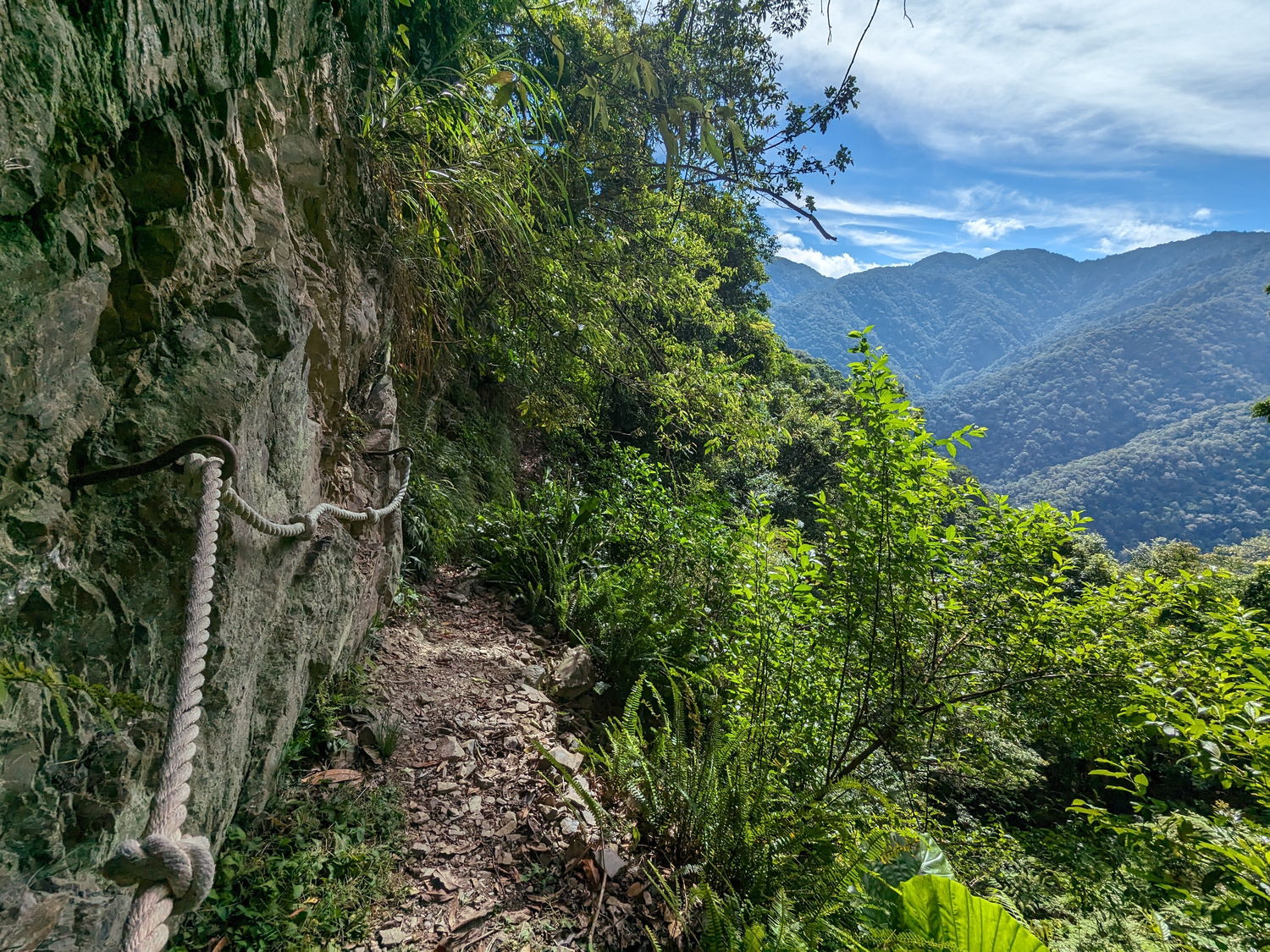
This mountain cross trail runs from all the way to Fushan to Yilan; it is a captivating trail that meanders along the picturesque bank of the upper Nanshi River. It was once known to the local people as the “wedding trail.” Atayal people of Wulai and their fellow citizens in the Yilan township would often do business with each other and intermarry. The Hapen Trail offered a connection between the two villages at a time when infrastructure was limited.
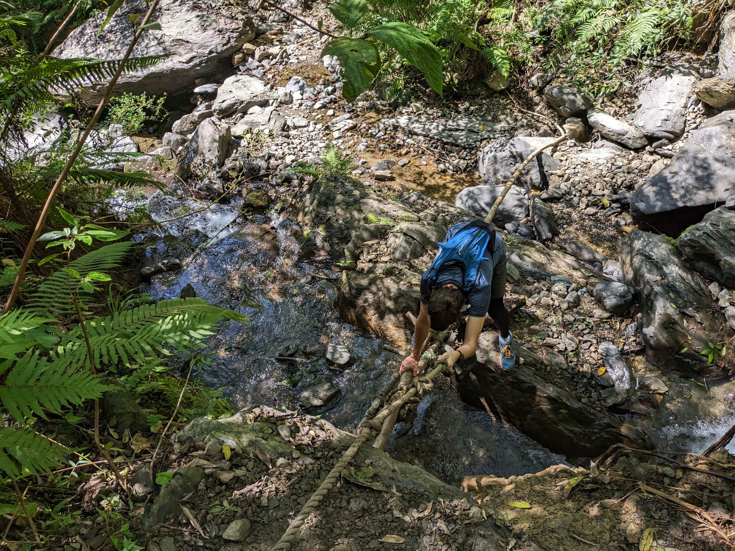

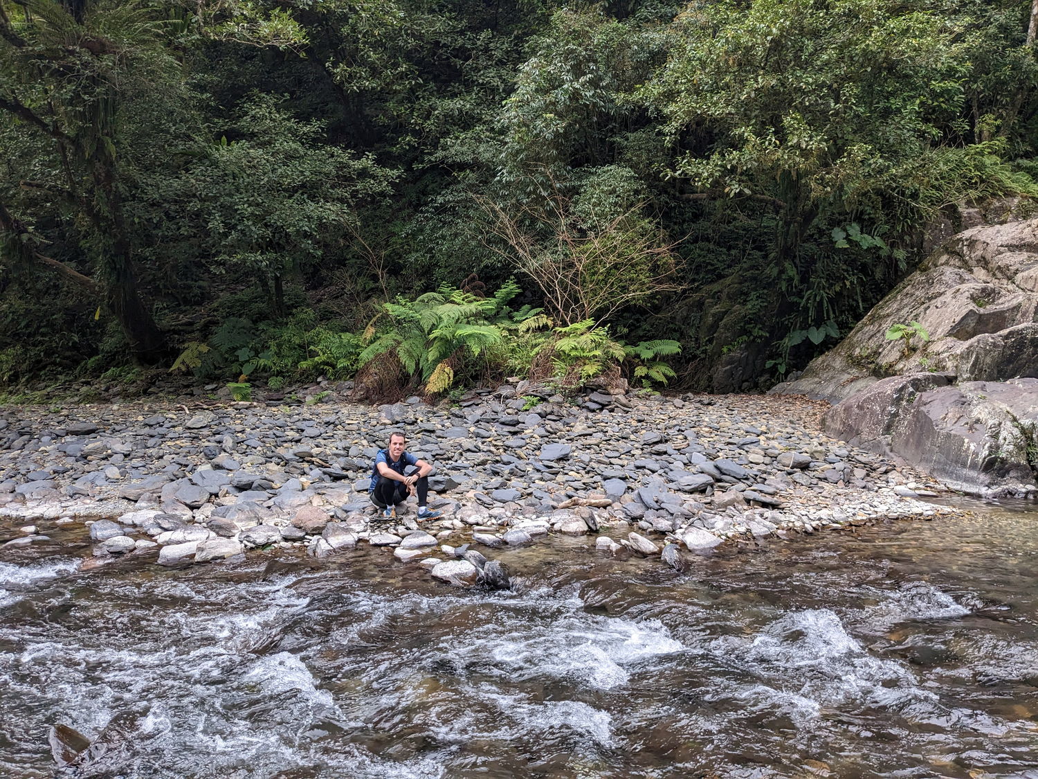
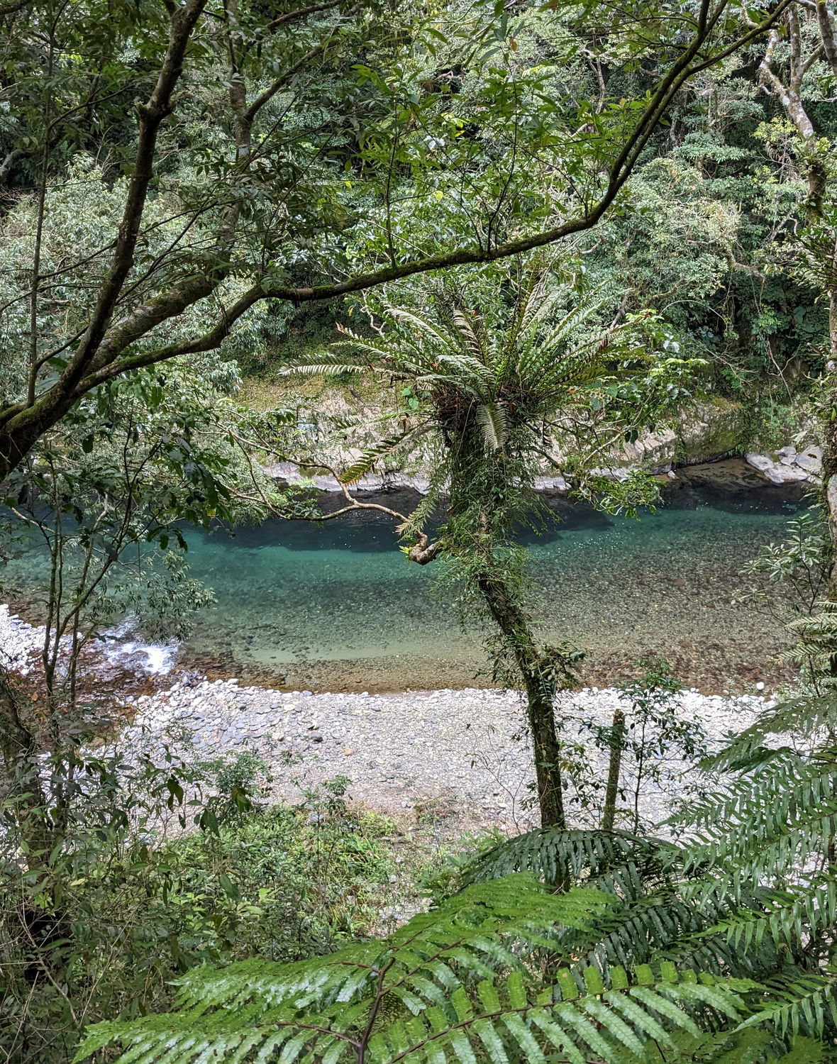
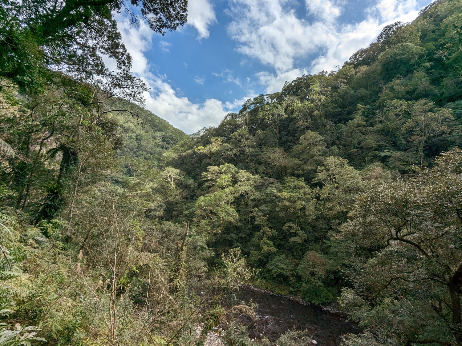

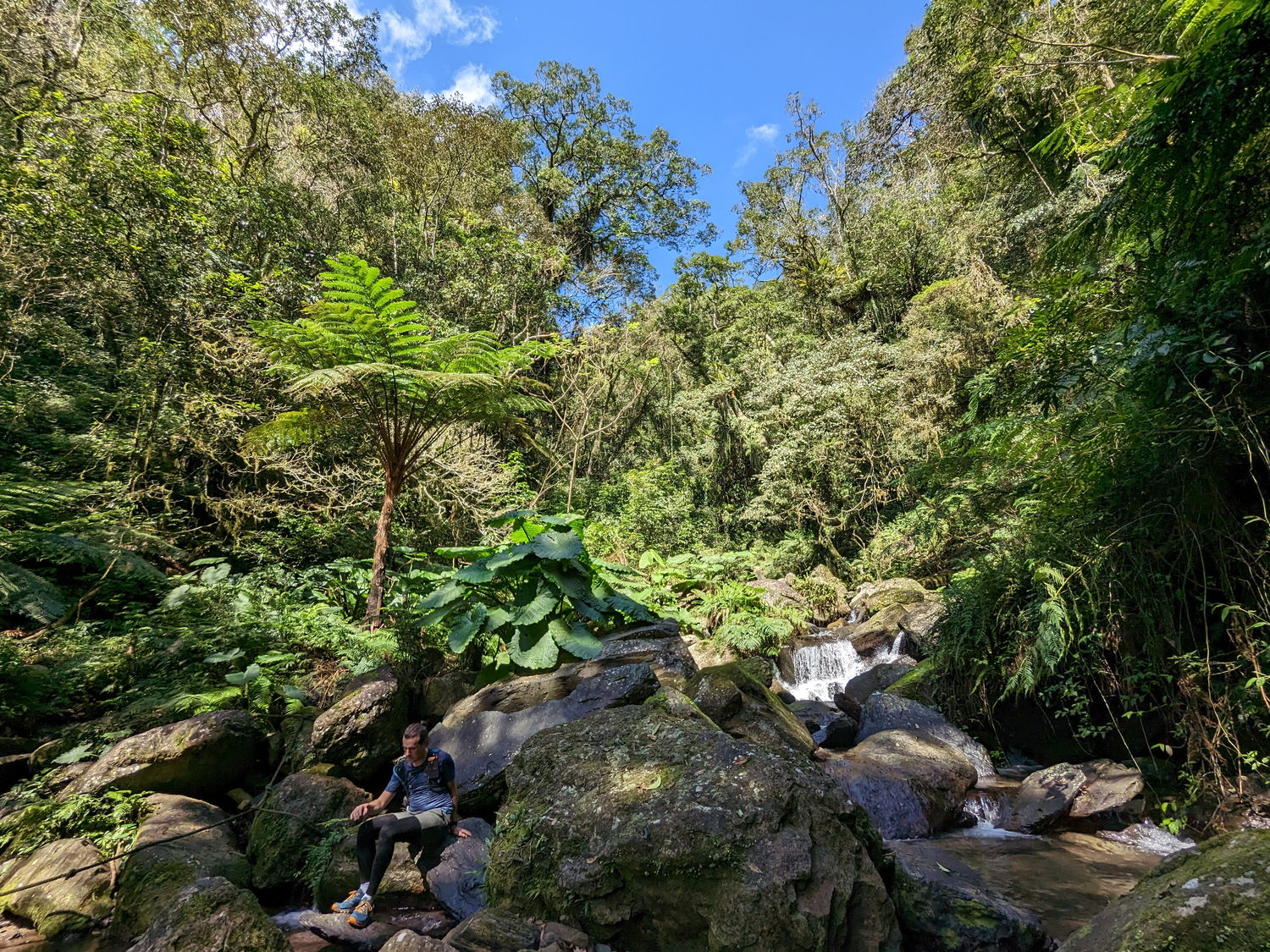
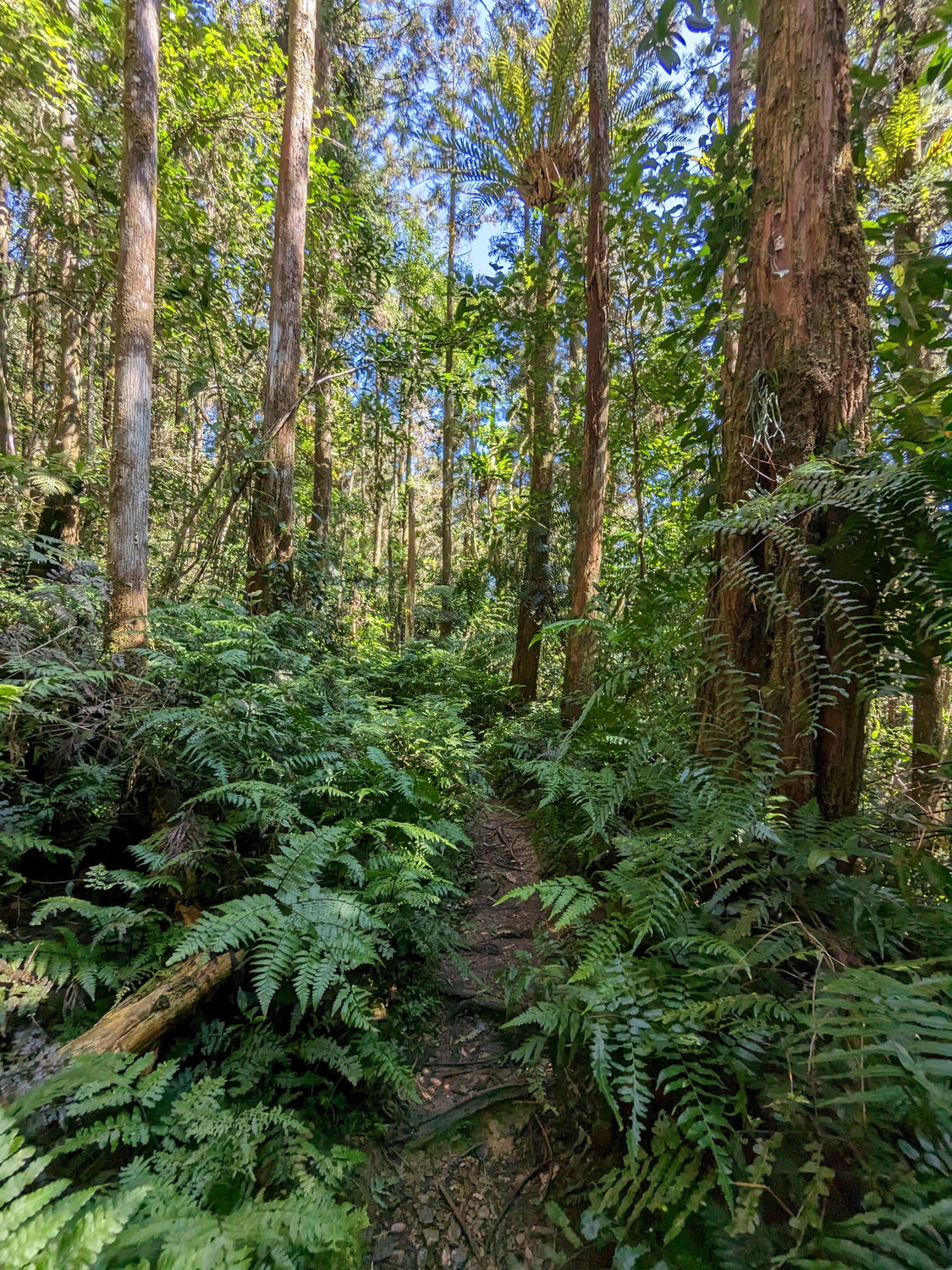

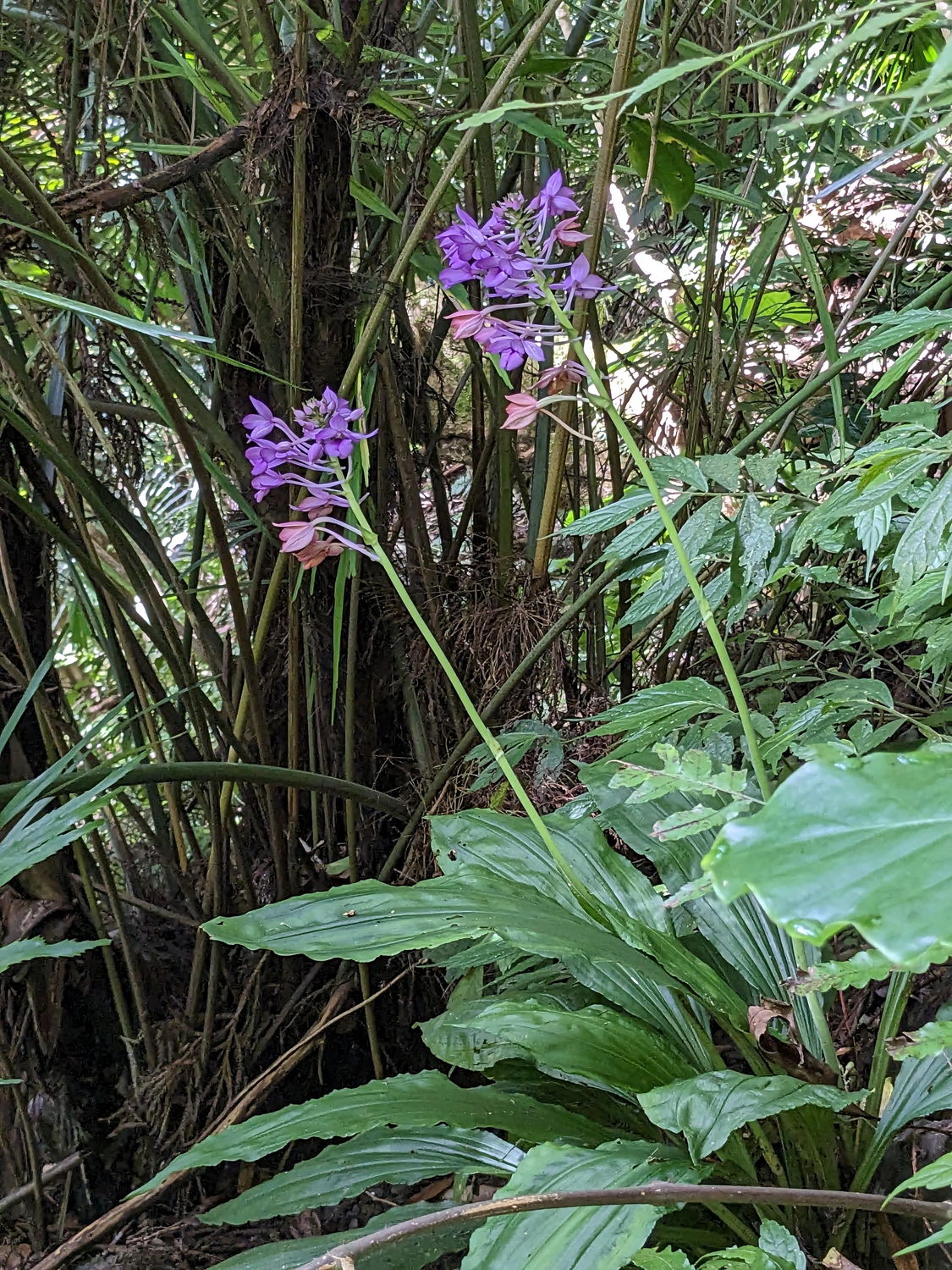
Often referred to as the “Amazon of Taiwan” you will be immersed in dense jungle forests and tranquil river landscapes. Along the way, you may encounter a variety of fauna and flora, including monkeys, huge butterflies and beautiful wildflowers. It is also a popular spot for fishing and swimming. If you hike this trail in the hot summer months, there are some amazing spots to cool down in the river along the trail. The trail is in good condition and it is well marked; there are a few landslides and steep sections that are easily navigated with the help of ropes. It is broad in some parts but narrower in others, especially in spring and summer when the ferns and grasses grow over the trail. You will need to cross the river multiple times, through deeper water as well, so be prepared for wet shoes or wear waterproof boots. Also be aware of leeches, which are common in the area. The trail goes up Nanshi Creek to Lumen Creek and ends along Ha Pen Creek, but the rebuilt trail ends at the junction of the Lumen River. We continued a little bit further, until circa 9 km into the trail, to Hapen River camp and then turned back on the original road. The round trip is about 20 kilometres and takes 5-6 hours.
It should be possible to continue your hike towards Yilan, but the trails in this section are not well-maintained and we do not have any information on their condition. The endpoint of the trail is the Fushan Botanical Garden, which is a natural ecological reserve. The reserve is strictly controlled and you will be fined if you do not apply for permission to enter. Additionally, it is a 20-kilometer walk from the botanical garden to Yilan, so most people choose to hike back the same way they came. It takes 3-4 hours to walk from the trailhead to the Hapen camp, just outside the ecological protection area and around 2-3 hours back to the trailhead from here.
The trailhead is located near Fushan at the Karamoji Industrial Road on the opposite bank of Fushan Village (see map).
Additional resources
- Information about the trail in English: https://trail.tacp.gov.tw/en/ExploringHistoricTrails/HapenHistoricTrail
- Website in Chinese with updates on the trail status: https://recreation.forest.gov.tw/Trail/RT?tr_id=031
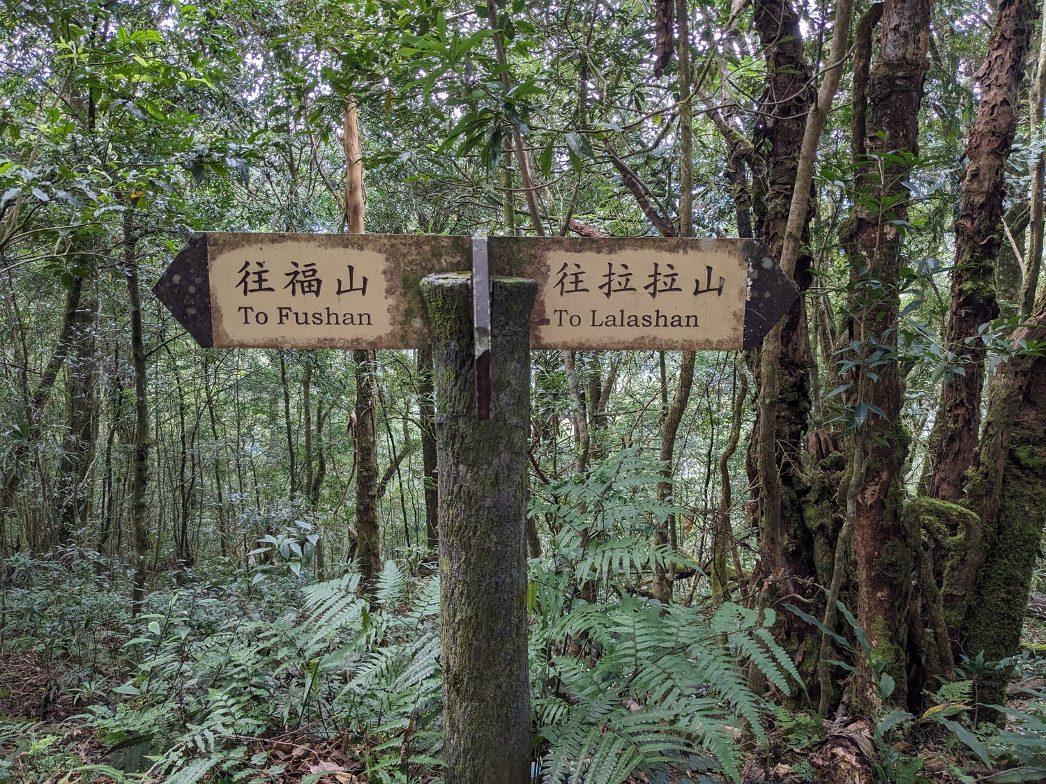
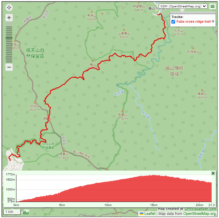
3 – Fuba Cross Ridge Historic Trail (福巴越嶺古道)
The Fuba Cross Ridge historic trail was constructed to connect the indigenous villages at Fushan and Lalashan. The Atayal people initially used it for hunting, visiting relatives and attending wedding ceremonies. During the Japanese occupation, it was designated as a defence line against the indigenous people and many police stations were built along the route as checkpoints. Today, the ruins of police stations can still be seen. In recent years, the Forestry Bureau has renovated the trail, improving the signage, adding ropes, and making it more accessible. The original trail is 17 km long and takes around 5-7 hours to hike when doing the uphill route starting from Fushan.
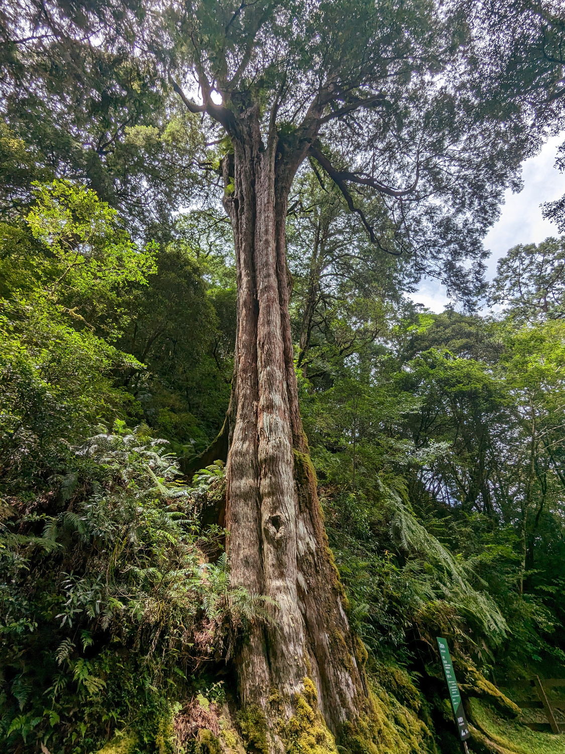

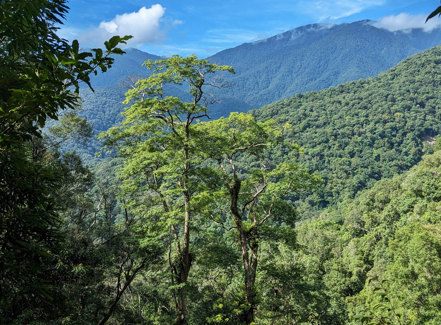

The Fuba trail is a wild trail with a remote feeling, as only a few hikers enter this area each day. This trail is not recommended for beginners as it is the most challenging of the three historic trails. It has an elevation gain of over 1,300 meters, and the trail crosses steep edges, landslides, and fallen trees. This makes the hike challenging but also more rewarding. A large part of the trail runs through Chatianshan nature reserve, which is known for the many giant red cypress trees which are dotted along the trail. It is also an important habitat for wild animals; according to the regulation you have to apply for permission beforehand to enter the forest reserve, which can be done online until a week before your desired date. The daily carrying capacity of this route is limited to 150 people.
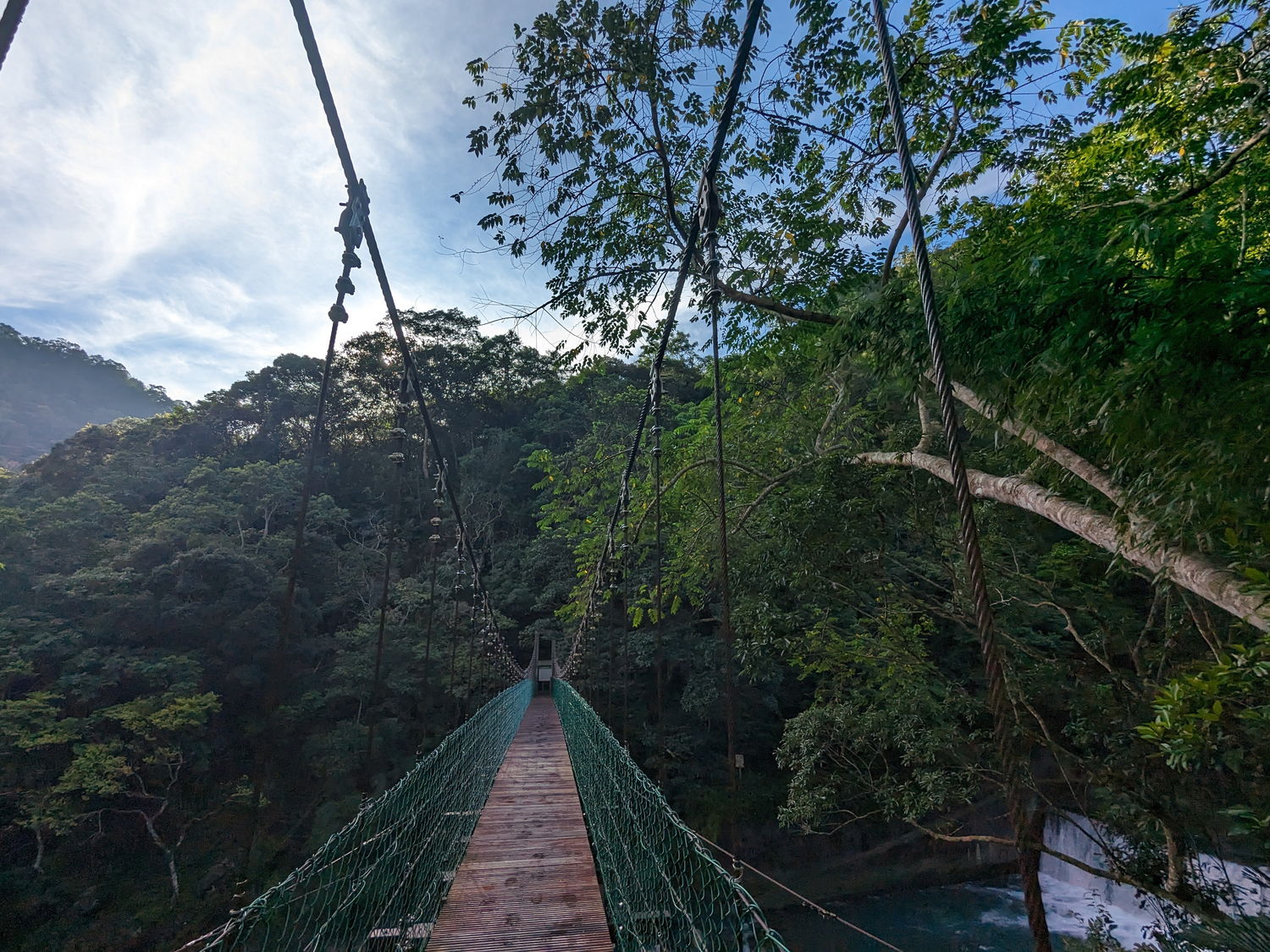
Right at the start of the trail from Fushan village, you cross a beautiful suspension bridge and leave the river behind as you start ascending. The trail gradually ascents while following the ridgeline and you can clearly observe changes in vegetation as you get higher up the mountains. The trail ends at the Lalashan Natural Forest Recreation Area, which is located at an altitude of about 1,600 meters. Here, you will be surrounded by a large number of impressive giant red cypress trees that are over 1,000 years old. The oldest tree is even 2,800 years old! It’s possible to add an extra loop to the hike to check out these trees, the Lalashan Giant Tree Trail. The trees on this trail are all marked with information signs, and it is a great way to learn about these ancient trees and round up this beautiful hike.
The trailhead is located in Fushan Village, the last real settlement south of Wulai. From the Lalashan visitor centre, you need to walk down a few kilometres to reach the bus stop where a few daily buses (5091 and 5301) run from Lalashan towards Taoyuan train station. At the time of writing the last bus departs here at 15.30, so make sure to start hiking early in the morning.
Additional resources
- A government website that some route information and updates on trail status: https://recreation.forest.gov.tw/Trail/RT?tr_id=024
- Link to application for Chatianshan nature reserve: https://pa.forest.gov.tw/
- Lalashan Forest Recreation Park website: https://recreation.forest.gov.tw/Forest/RA?typ_id=0200005
- Bustracker app to check bus schedules and live updates: https://play.google.com/store/apps/details?id=nexti.android.bustaiwan&hl=en_US&pli=1
Tips and recommendations
These are general tips for all trails. It is always best to be prepared for anything, including bringing the necessary supplies, such as food, water, and a first-aid kit.
- Consider bringing a pair of gloves for the ropes along the trails to prevent blisters on your hands;
- The trails might get muddy and slippery when it rains and the water flow in the rivers can increase quickly; always check the weather forecast before venturing out. Also, the weather may change quickly in the mountains, so be prepared and bring some extra layers and an extra set of dry clothes. Taiwan weather apps: https://www.cwb.gov.tw/V8/E/S/eservice/app/app_w.html ; https://www.windy.com/?25.050,121.532,5 ;
- It is not recommended to hike after heavy rainfall or during typhoon warnings;
- Bring some swimming clothes/dry clothes if you like to take a dip in the crystal clear creeks along the Tonghou or Hapen trail;
- In summer especially, most days you’ll have clear mornings with afternoon showers, so make sure to start your hikes early in the morning;
- Treat yourself to a private hot spring in Wulai village after doing one of these hikes during the winter months. There are multiple hotels that offer 1-hour hot spring baths for around 200 Taiwan Dollar pp. Or go local and visit one of the wild hot springs down the river at Wulai, location on maps:https://goo.gl/maps/tSuTdVSz13X5u2ck8 .


This blog makes me want to go to Taiwan again! ❤️