
Hiking Kumano Kodo in winter (Nakahechi route)
Japan. It always sounded far away; literally the other end of the world when we grew up. But over the last few years, while living in Taiwan, it was a lot closer, yet still unreachable due to the pandemic. This January, however, we finally had a chance to explore Japan. We decided to go hiking and winter camping. Japan is a vast country with lots of trails and history, but we only had one week. Eventually we chose the Kansai region to do a four-day hike in the Wakayama prefecture and explore Kyoto and Nara afterwards and we certainly have no regrets!
Japan has many long-distance trails with great history, but one stood out for us in particular; the ancient Kumano Kodo pilgrimage trail. The Kumano Kodo is a pilgrimage network along the steep mountain ridges of the remote Kii Peninsula in the Wakayama Prefecture, circa 100 km South of Osaka. It is a great route to explore the cultural and natural heritage, and traverse mountain ridges where pilgrims have walked for over a 1.000 years. Moreover, this is the only of two UNESCO World Heritage trails (together with the famous Camino de Santiago pilgrimage in Spain). We selected the Nakachegi route, which stretches over 100 km from Kii-Tanabe via Hongu to the fishing village Kii-Katsuura, with a total elevation gain of ca. 4.500m. The earliest records from this route date back to the beginning of the 10th century.
A few good sources of information are available on the hike and accommodations along the trail (see bottom of page). The Kumano local community website is a great start. At the tourist information in Kii-Tanabe or the trailhead, they also provide an excellent free guidebook of all the routes, with maps, altitude profiles, trail info and info about accommodations. If you want to stay in traditional guesthouses along the trail, it’s recommended to book in advance through the same community website (some are now on booking.com as well). We, however, wanted to spice things up a bit (or rather chill down) by camping along the trail. This is very well possible in winter, but there is not much information out there. That’s why we decided to share some of our experiences with camping along the Kumano kodo trail and sharing the pros and cons of hiking this trail in winter. We included our .gpx files for those interested.
Since our schedule was a bit tight, we chose to do the hike in four days, but to be honest, it might be even more enjoyable in five or six days. Although you can keep to the schedule of 4 hiking days, spending more time wandering through the rural villages and bathing in the different onsens (hot springs) might be more relaxing. There are hardly any food points along the trail, and restaurants in the villages tend to close early, especially in wintertime, so it’s best to bring your own food.
Day 1: Takijiri – Chikatsuyu
We spent the night at Kii-Tanabe to get an early morning start for the first stretch. The town of Tanabe itself has excellent accommodations and restaurants and is well connected by JR west trains. The ramen place next to the railway station was a treat for us since we still needed to adjust to the real winter cold, coming from Taiwan; no better way than doing that with a steaming bowl of spicy ramen! We also needed some supplies for the walk, and surprisingly the 7-11 at the train station has this well covered. If you’ve some excess luggage, you can also store this in the coin-lockers at the station (400 yen per day). Don’t forget to stop at the tourist information here since they have an excellent free hike map and might have some up-to-date information on trail conditions and campsites. The train station is also where you can start the hike, but be aware that it will still be around 20 kilometres to the trail entrance. Since this is mainly along busy roads and residential areas, we took the first-morning bus to the trail entrance. Google Maps is your friend regarding public transport in Japan, as every bus and the connection is displayed in real-time.
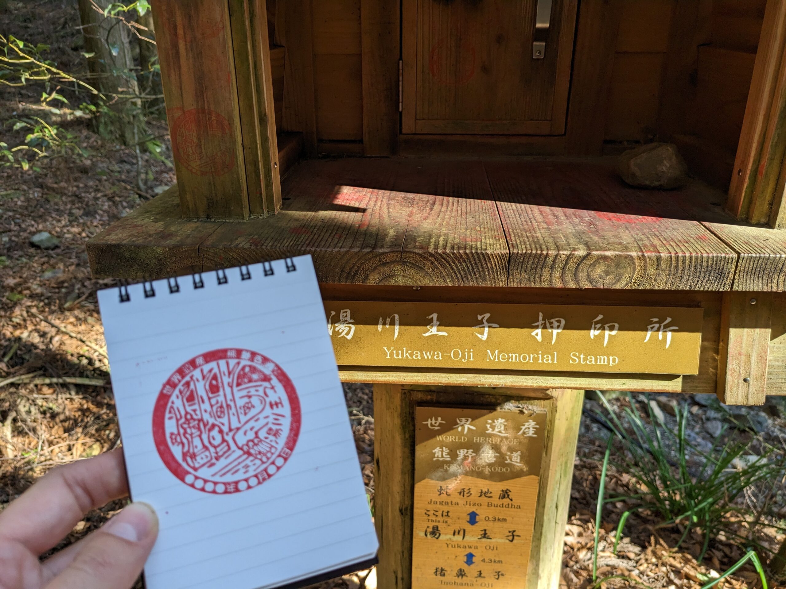
Take the bus (nr. 85 when we were there) to the Takijiri stop, near the Kumano kodo information centre. At the information centre, you can get more information on the trail, and there is a small exhibit on artefacts found along the route. The place was deserted in winter, but all the facilities were open. Across the road from the information centre, a small shrine marks the start of the trail. You’ll start with a steep ascend over ancient cobblestones and test your lung capacity. To add to the heroic aspect of the Kumano Kodo trail, stamps can be collected along the way at certain points of interest; this reminded us a bit of the “elfstedentocht”. For the non-Dutch, this is a Speed skating competition on over 200 km of natural ice, where you have to collect stamps in each of the 11 cities along the way. Of course, we had our stamp book ready and got our first stamp along the trail!

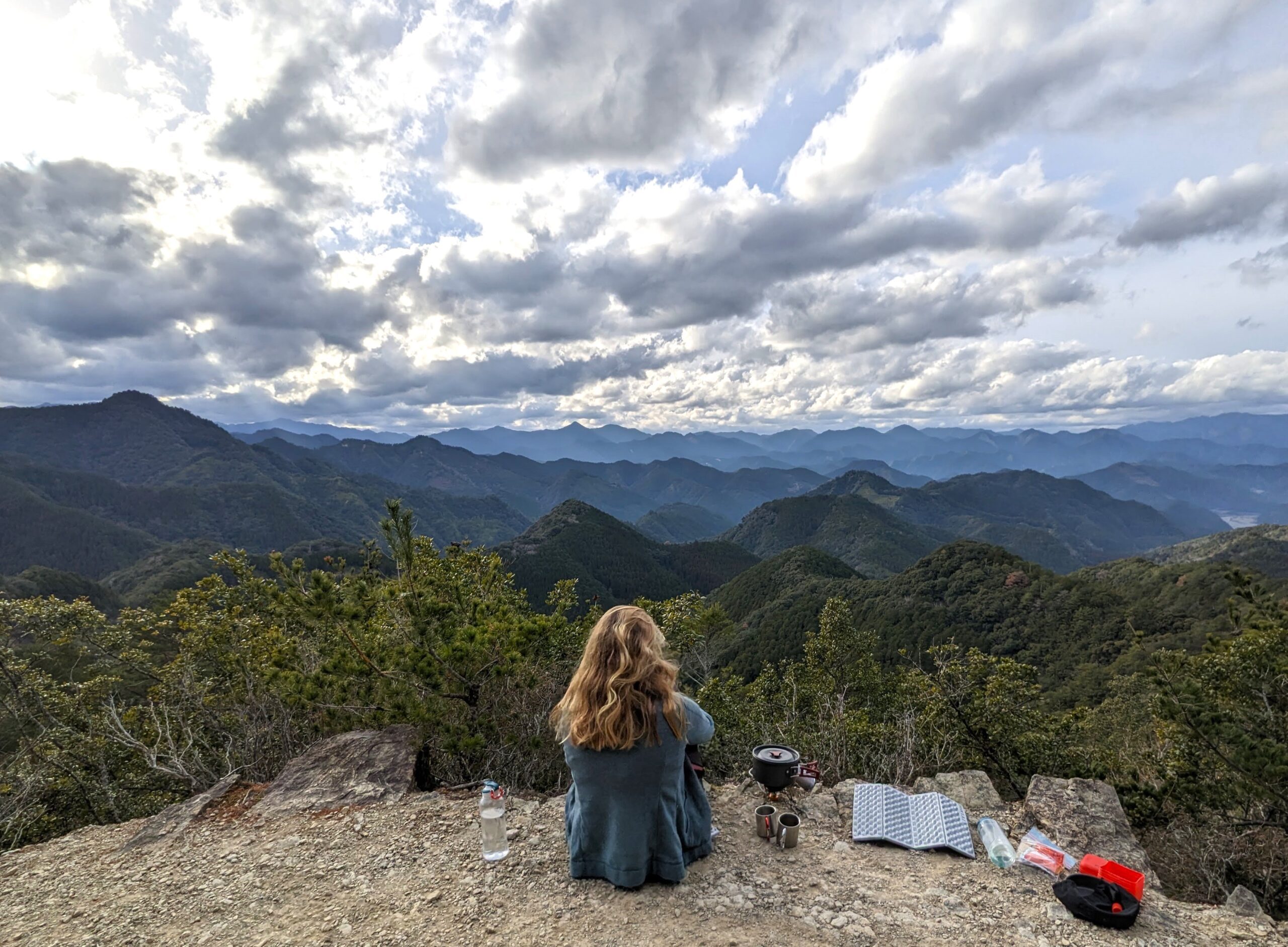
After the first climb, we ended up in a small village (Takahara) that seemed pretty much deserted. We took in the beautiful panorama of the rice terraces when a small truck showed up. To our surprise, many (elderly) people suddenly appeared and gathered around the truck, which turned out to be a driving supermarket. This is a great service for remote villages, especially in Japan’s increasingly ageing and depopulating rural areas. From the village, you start climbing again through a beautiful pine forest, but first, make a stop at the ancient Takahara Kumano shrine, surrounded by old camphor trees. The second climb of the day is more gradual, and you’ll pass a few smaller shrines (where you can collect more stamps) until you descend towards Chikatsuyu village. Chikatsusyu is located in the Hiki river valley, and this village has some stores and restaurants, but they all close early (around 6 pm). When we found out that all stores in town were closed, daylight was almost gone, and the cold also came in quickly. Fortunately it was only a short walk to the other end of the town and down the riverbank to the beautiful campsite (Iris Park campground). While the owner was surprised to see hikers (especially after the sun was down), camping was no problem and was really affordable (2300 yen). The campsite is open in the winter season, and to our surprise, it even has its own onsen bath, which was more than welcome to warm up and relieve our sore muscles. After the onsen, it was time to get into our warm sleeping bags, which were comfortable during the freezing cold at night, especially considering the frozen condensation on the outer layer of the tent we discovered the following day.
Day 2: Chikatsuyu – Yunomine Onsen village
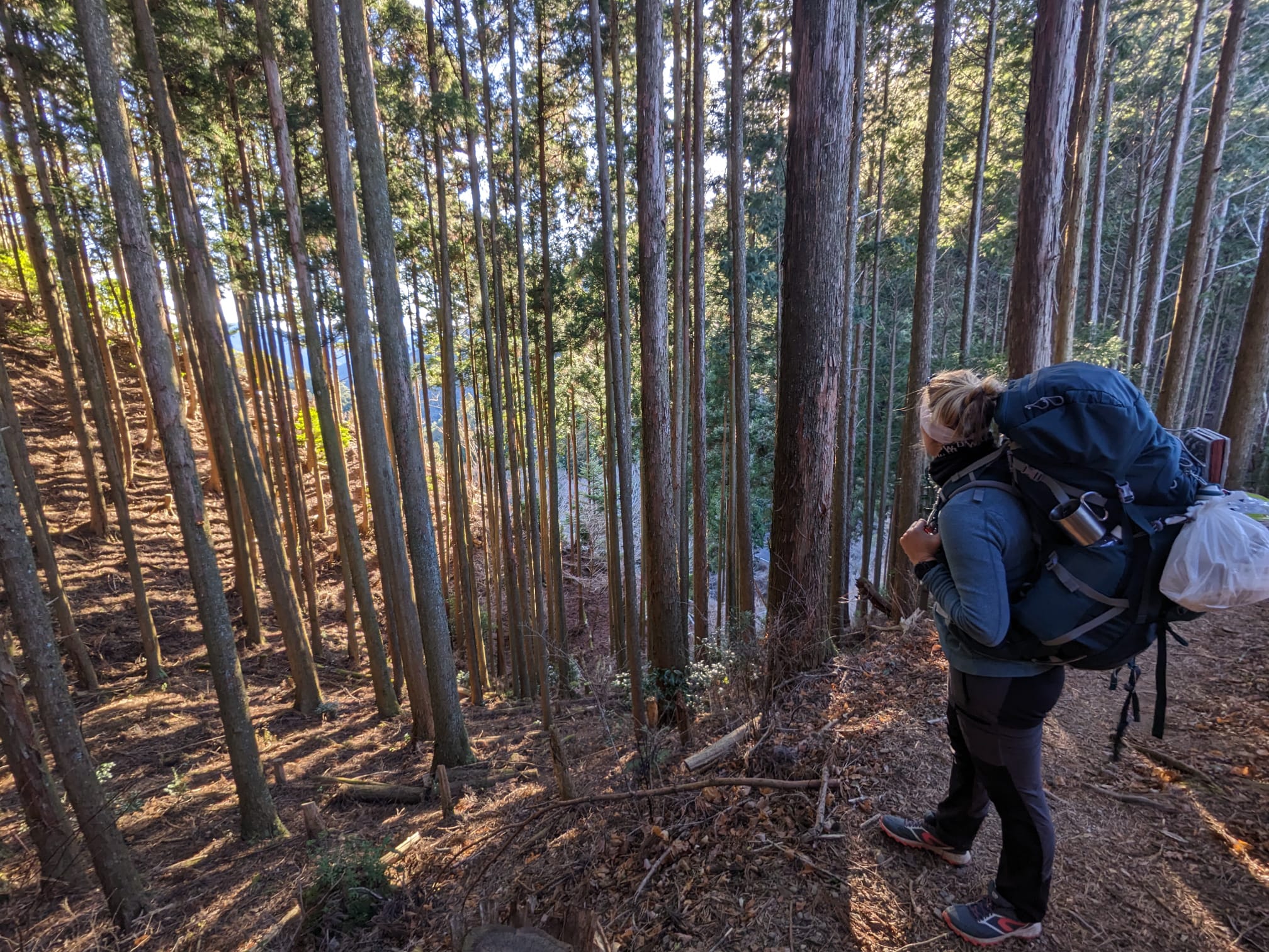
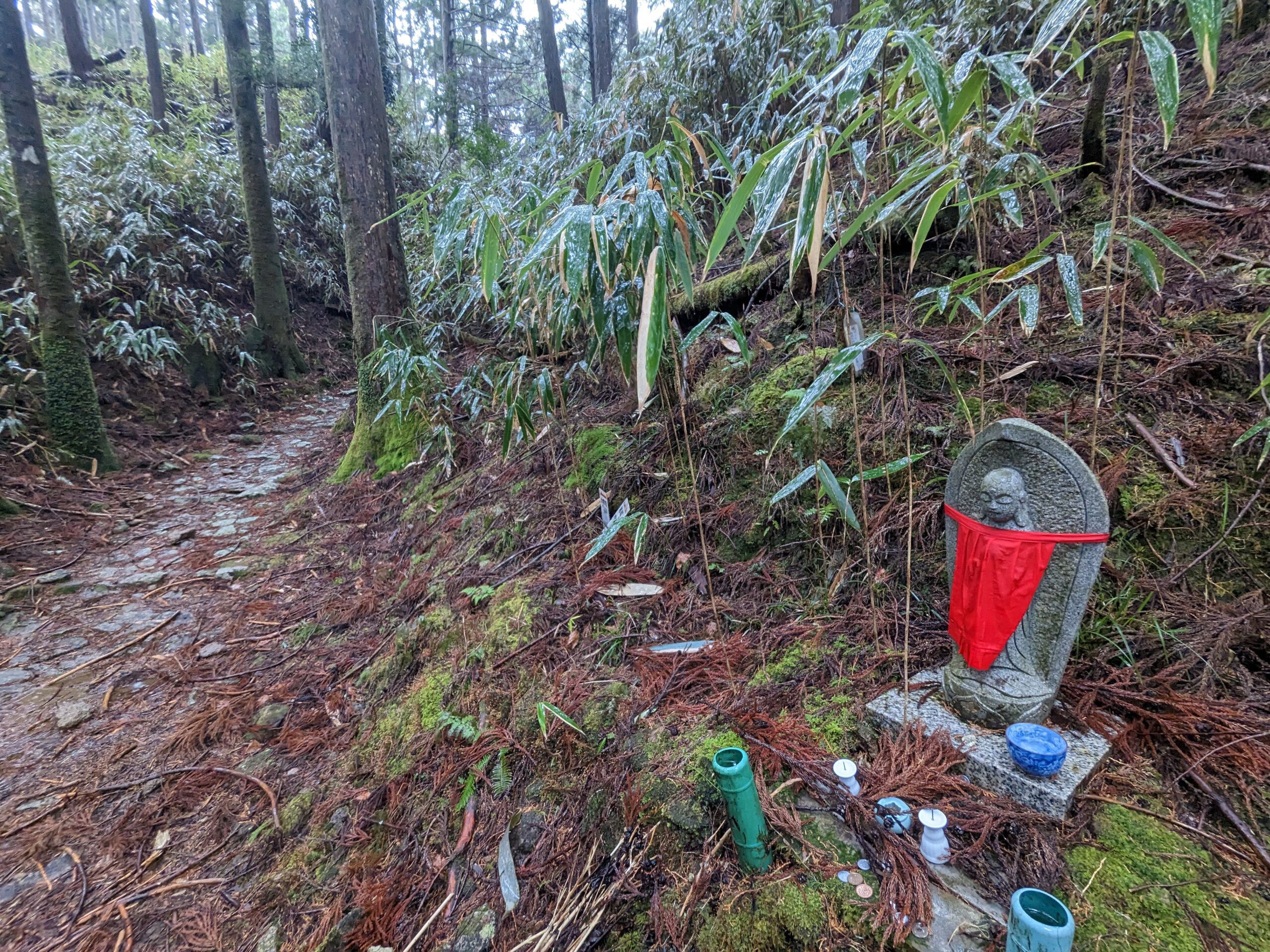
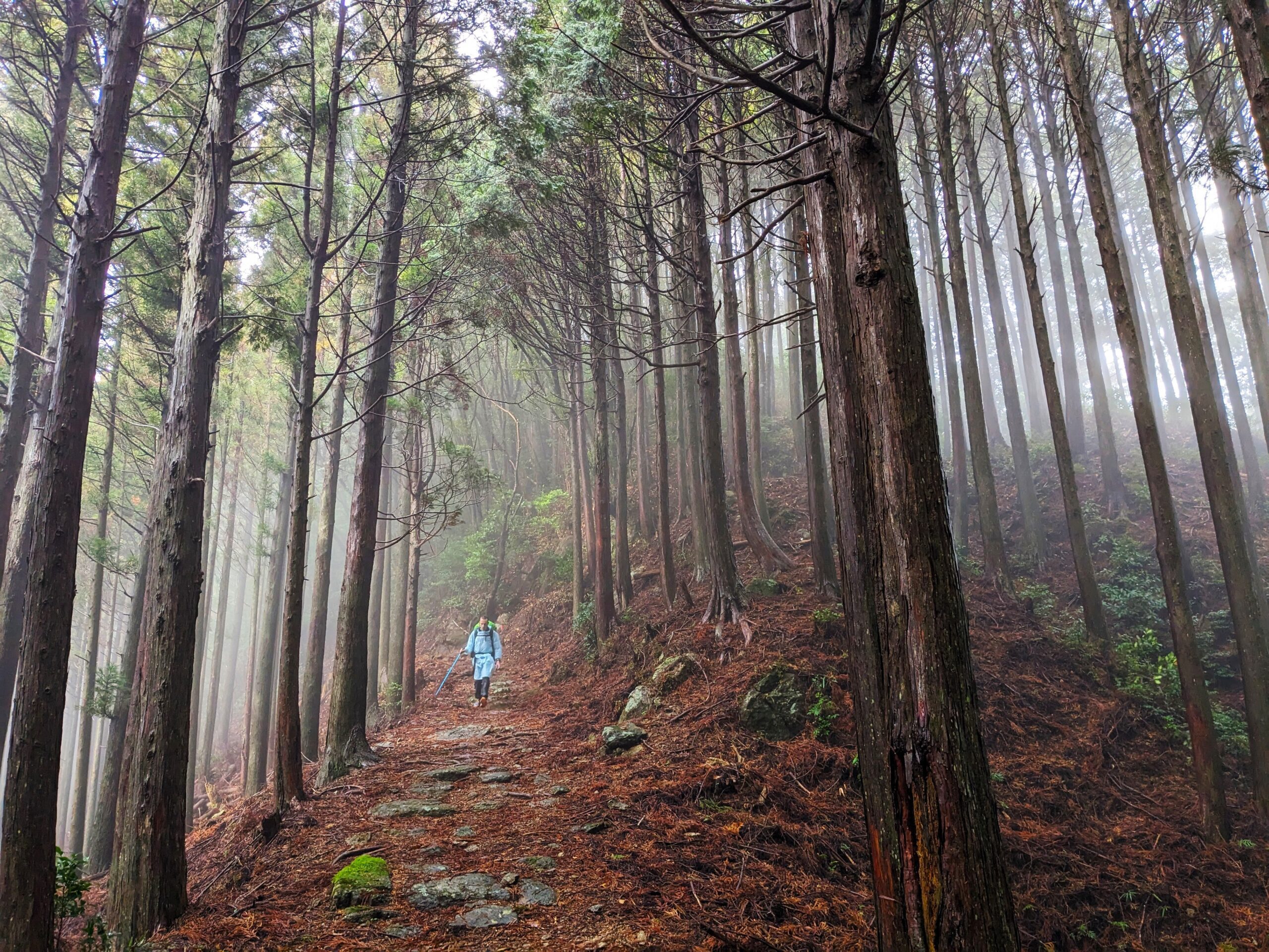
This day started in the early morning when the alarm woke us up and told us we had to leave the warm comfort of our down sleeping bags, but it also gave us a chance to see where we arrived the night before in the first daylight. We got some visual reminders of how cold it was; besides the usual steam breath, the outer tent was solid frozen from the build-up condensation. Our solid frozen clothes reminded us that drying your clothes outside in the freezing cold is utterly useless. After we ate the remains of a 7-11 bag of chocolate croissants, it was time to hit the road and hike up from the river bedding where the campsite was located. The second day of hiking would lead us along bamboo groves, ancient cedar trees, shrines and thick green forests, with an occasional viewing point. The morning stretch started with small tarmac roads through tiny rustic villages and, after a while, turned into a forest trail. While it really felt like we were all alone, the surprising reality was that we were never far away from roads according to the map, we never noticed though. While the sun was slowly warming up the winter air, it created beautiful light in the forest, and we were in for a sunny day. At a small river crossing somewhere around the halfway point of the day, we decided to prepare lunch and filter some water along the way. It was such a lovely spot that we probably stayed too long before starting another ascent. Along the way, we saw again many shrines, some in better shape than others, and specifically on this stretch, most of them were decorated with paper folded in the form of lightning (gohei).
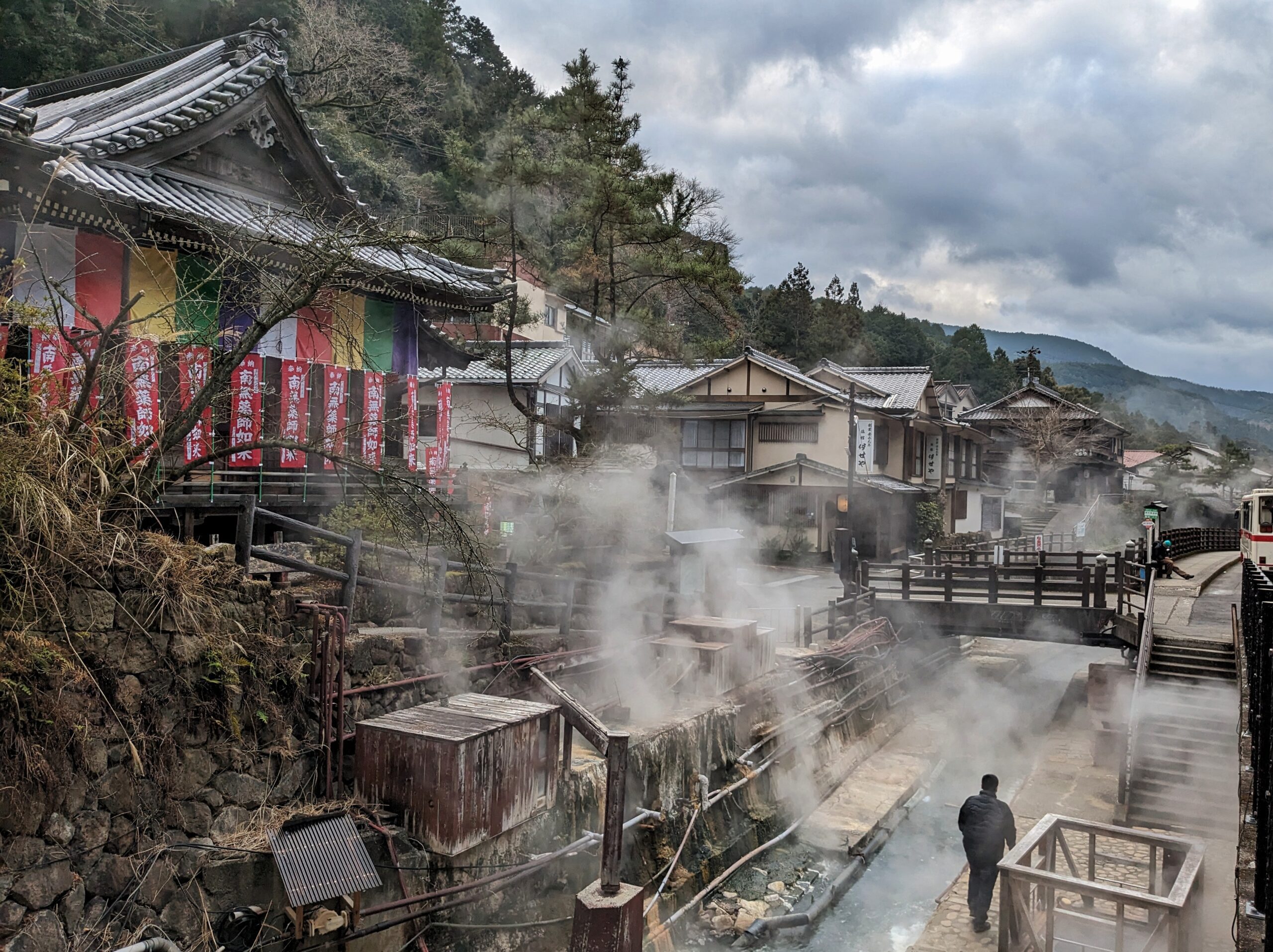
This stretch of the trail had many crossings with smaller roads, and multiple times at such crossings were toilet buildings. It was remarkable to see how good and clean these facilities were! At the end of the day, we decided on one of those crossings to enjoy the last bit of sun before heading into a stretch of dark forest for the rest of the afternoon/evening. Again, this was just too nice, making us take an extended break while soaking up the sun and enjoying a Kumano Kodo-themed IPA we’ve been carrying for two days. We ended our day in Yunomine Onsen, which has a long history, as pilgrims would use the hot water for purification rituals as part of the religious process of their pilgrimage (and we guess to warm up during the cold winters). We were happy to clean up and warm up our cold limbs. For the second night, we decided to book a hotel in Yunomine and experience the Japanese-style futon beds on tatami mats and a private onsen, a lovely change from a cold night in the tent.
Day 3: Yunomine – Koguchi
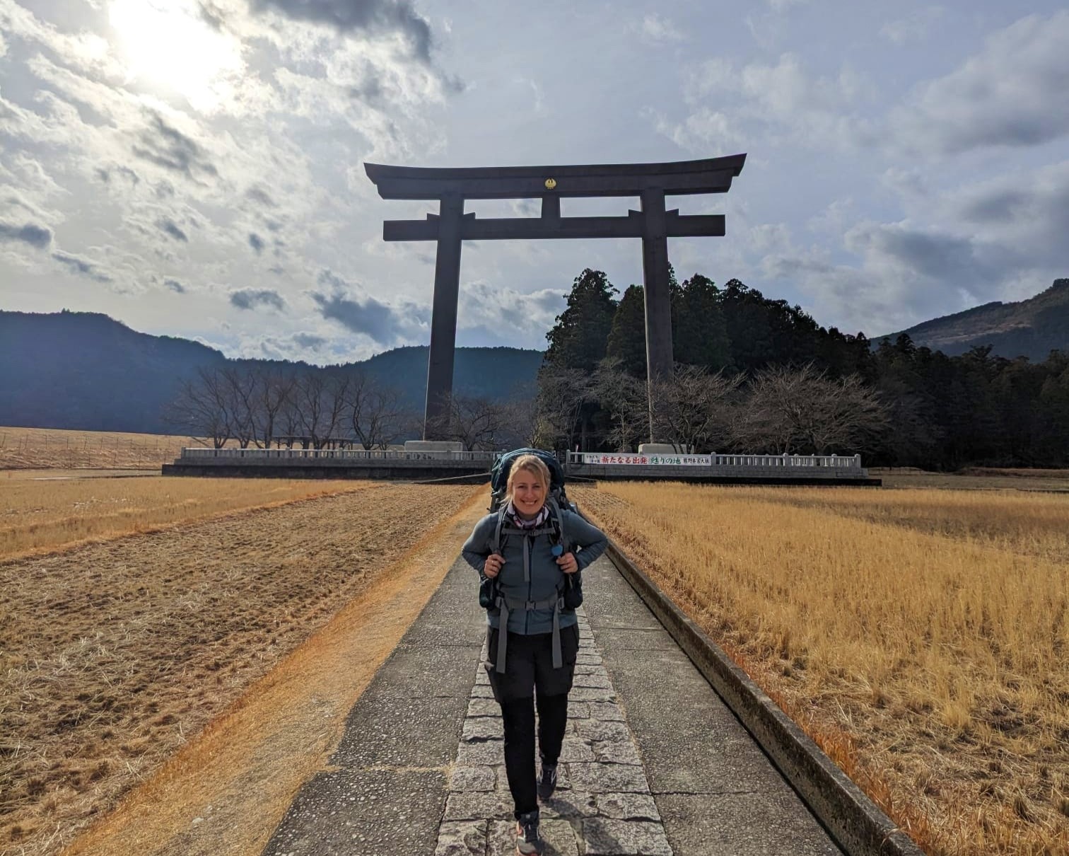
After recovering in the fantastic hot springs, it was time to move on and hit the road again. Our first pit stop was Hongu, where you can find the world’s biggest torii gate and one of the three famous shrines along this pilgrimage; the Kumano Hongu Taisha.
The giant Hongu Oyunohara torii gate is very impressive; you can see it standing out from everywhere in the village. From the north, there is a spectacular approach through open rice fields with a backdrop of mountains and pine trees. After getting a closer look at the gate and concluding that it definitely is vast, we visited the shrines of Kumano Hongu Taisha. It’s a massive complex as it serves as the head shrine of over 3000 Kumano shrines across Japan, and it lies at the centre of the Kumano Kodo network of pilgrimage routes.
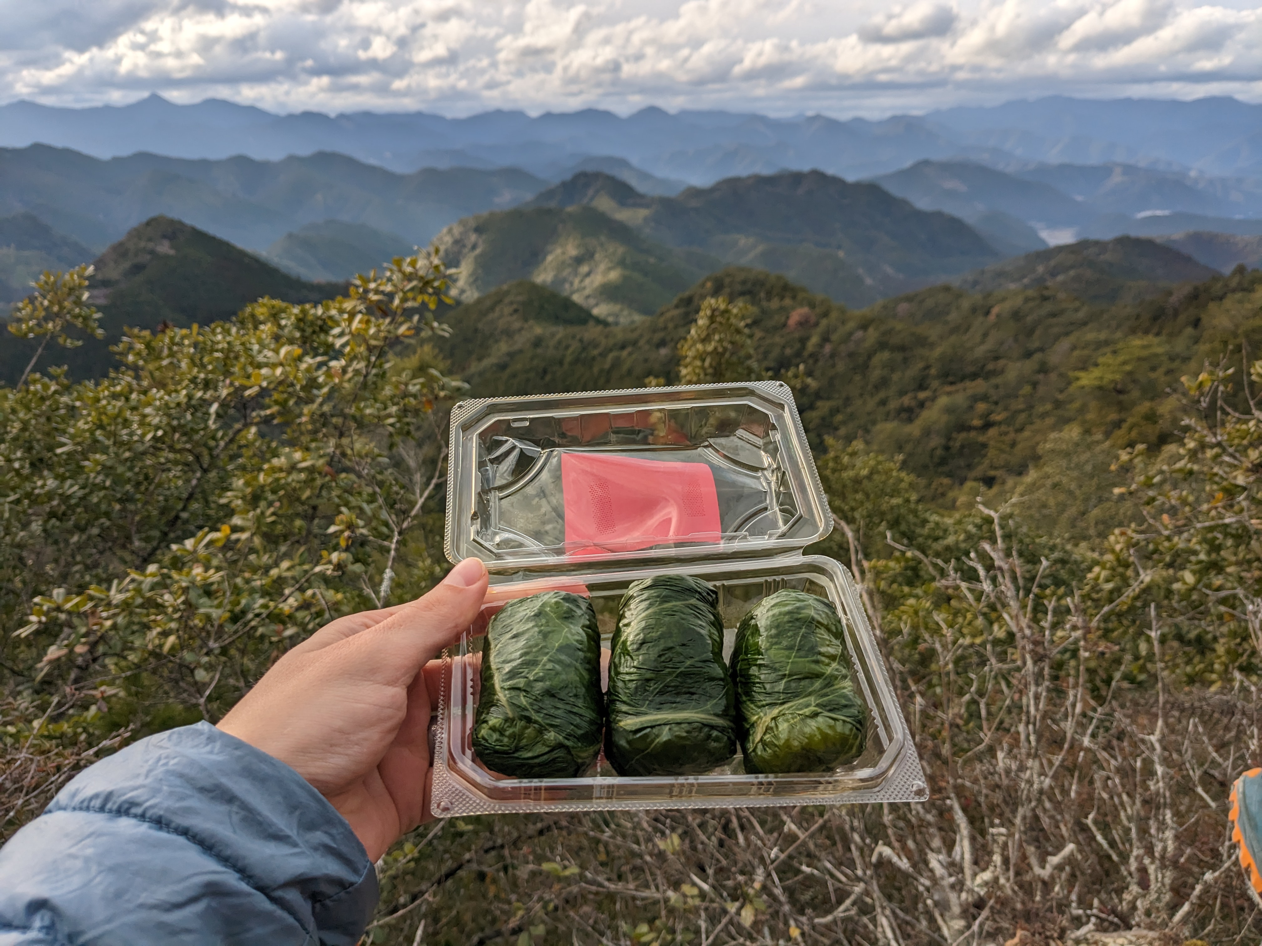
At the local shops, you can buy different Omamori (a type of amulet) used for many purposes, such as travel safety, health, warding off evil, etc. Images of the Yatagarasu, a three-legged crow born from the sun, are found throughout the village and are seen as pilgrims’ guides. During our hike, we were indeed surrounded by crows everywhere, none of them had three legs, though, but we’ll just ignore that tiny detail. You can try some local specialities in the village, for example, Mehari-sushi: rice wrapped in a pickled mustard leaf, ideal for taking with you on the road. Or insanely flavoured ice-creams; try a black sesame, matcha tea or tickle your taste buds with some fermented apricots.
To continue the trail, unfortunately, you must follow a long section along a busy road (around 3,5 km), where sometimes the paved walk disappears. We later discovered that many people take the bus from the Hongu visitor centre to Ukegawa Trailhead, which is a good alternative if you want to avoid this section. You will gradually climb through a beautiful deciduous forest from here until the Hyakken-gura viewpoint. It is called the 3,600 peaks of Kumano, which refers to a large number of ridges and peaks that can be seen from here. We took a rest stop and prepared some lunch, which caught the attention of several loud monkeys nearby. Fortunately, they let us eat our lunch, although we heard them coming closer and closer. It’s the only wildlife we have encountered so far besides the occasional squirrel. Although there are a lot of warning signs for bears occurring in these regions, we did not see any because they’re hibernating at this time of the year. This whole section of the trail is relatively mild, and we ended our day at Koguchi around sunset. We found a campsite (Shingushi Koguchi campground) next to a river, which unfortunately was closed. But we met some other hikers and pitched our tents at the terrain of the campsite, which was still accessible. We bought a delicious meal at the local store in Hongu; they sell a wide selection of curry sauces in almost every supermarket, which you can quickly make with some pre-cooked rice.
Day 4: Koguchi – Kii-Katsuura
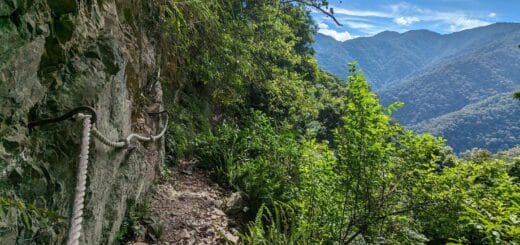
This was by far the most challenging day. We enjoyed three days of sunshine and a manageable amount of uphill/downhill ratio. However, it was pouring rain this day, and we had to tackle the most challenging climb on the trail right at the start of the day. We were prepared and left early because we knew that many pilgrims considered this part arduous. And as the Dutch would say: ‘a warned man counts as two’. Multiple poets have complained about the strenuous climb and the seemingly endless slope of the Echizen-toge Pass. Some were even lost for words, as it was mentioned that it was impossible to describe precisely how tough it is. Now, we would say this is a little exaggerated…when you come prepared and take it easy, you’ll reach the end of the 800 m climb before you know it. Just don’t count the number of green mossy stairs, or don’t look up; they might seem to be never-ending.


Once you make it up the stairs, you can celebrate; the most challenging part is behind you. From here, the route goes up and down through beautiful forests and along wild rivers. There are a few kilometres of paved road, as part of the route here is diverted because of landslides. But this part was a welcome change from the slippery cobblestones during the rainy day. We didn’t take a lot of breaks because of the rain and walked at a steady pace. There are no places to provide food along this section besides the occasional vending machine (which sells hot soup and warm drinks!). You do pass many old tea houses remains, which make you wonder how it must have been walking here in the old days. Of course, we had our stamp book still at hand so we would not end up like Piet Kleine, but the rain added some challenges to the stamping.
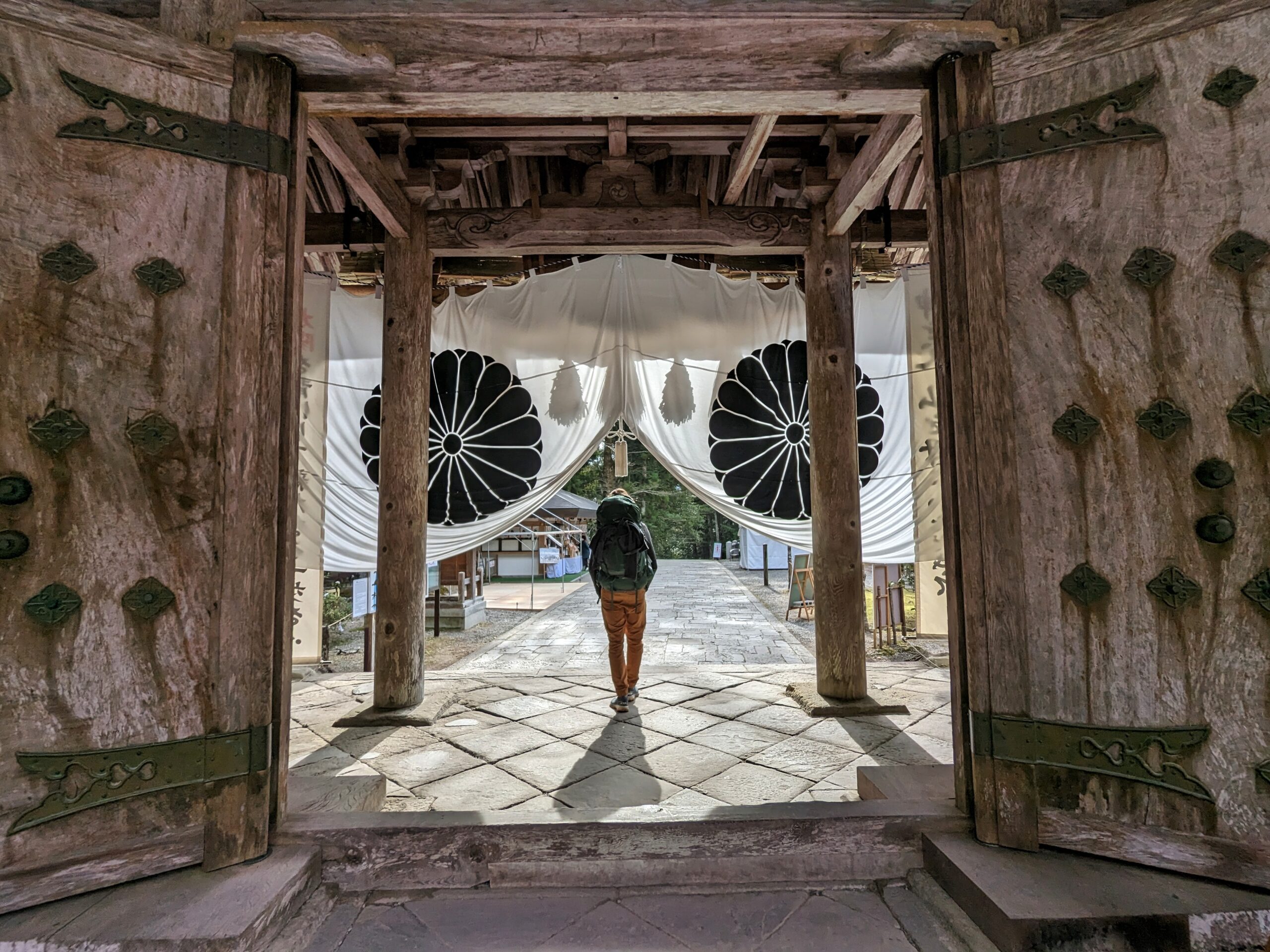
Fortunately, it cleared up in the afternoon when we got close to the famous Kumano Nachi Taisha (one of the three grand Kumano shrines) and the Nachi Falls. This is considered the endpoint of the ancient pilgrimage, and the colossal waterfall next to the three-tiered pagoda is a breathtaking sight when you emerge from the forest. The 133m high Nachi falls (Nachi-no-Otaki) is the tallest waterfall in Japan, surrounded by broad-leaf evergreen primaeval forest. It is a protected ancient sanctuary used for the training of mountain monks. The shrine of Kuman Nachi Taisha and the Buddhist temple of Eigano-ji are on top of the hill, which also has a great view of the waterfall and pagoda. It’s a beautiful shrine where many pilgrims are busy paying their tributes to the 12 deities of Kumano, but we couldn’t keep our eyes off the stunning 1000-year-old camphor tree, which arches over the whole complex with heavy, gnarled branches. After a late lunch (mind that most lunch places close already around 1.30 pm), we visited the waterfall and continued our route towards the coastal village of Kii-Katsuura, around 7 km down ancient cobblestone stairs and rural villages. Are your legs too tired to continue? No problem, you can also take the bus from the Nachi falls to Kii-Katsuura, which goes quite frequently. Kii-Katsuura is a pleasant coastal village with many opportunities to eat fresh seafood. Love fish? Try out the super fresh seafood or sushi in Kii-Katsuura at Mehari Sushi Nidaime or Ichirin Izakaya. And celebrate finishing this amazing pilgrimage trail with a Kumano Kodo beer!
Pros and cons of hiking the Kumano Kodo trail in winter
Pro
- Fewer people on the trail (only saw four fellow hikers in 4 days’ time!
- Dry season, so there is a high chance of sunny days
- Cheap tickets to Japan (compared to sakura season and fall)
- Lower chance of encounters with snakes or killer bees
- Camping is still very well possible
Con
- It can be cold (pack accordingly); this also makes your pack heavier and camping more challenging.
- Fewer options for hotels and campsites (although you can just put your tent on deserted campgrounds)
- Few shops are open (but still options in most villages). Lookup opening hours beforehand
- Daylight is shorter (get a good headlamp)
Resources
- Official Kumano Website -This site from the Tanabe Tourism bureau has a lot of helpful information: maps, live trail conditions, booking accommodations, travel tips, etc.
- Japan guide – this website has valuable information on the pilgrimage network and travel advice in Japan.
- Maps.me is a helpful map app where you can import trail files